![]()
文字サイズ


キーワード「拓影展大 甲骨文字字典」の検索結果
光和書房
東京都千代田区神田小川町3-22-9 タイメイビル2F
東京都千代田区神田小川町3-22-9 タイメイビル2F
¥20,700
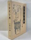
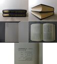
小林石寿、木耳社、1987-05、1
精装
登録書籍に「書影」文字がある場合は、「書影」文字をクリックすると大きい画像で書籍を確認できます。 スマホ閲覧の場合は、PC版サイトに変更の上、「書影」文字をクリックして画像詳細をご確認ください。
厚み3cm以下の商品は送料400円~です、それ以上の商品は佐川急便、全国(離島を除く)900円~です。 海外発送も対応致します。 現品確認をご希望される場合、ご連絡を頂いた上、対応致します。
**********
ご探究の中文書などがございましたら、気軽にご連絡ください、お探し致します。


古書 畸人堂
静岡県伊東市吉田
静岡県伊東市吉田
¥7,000
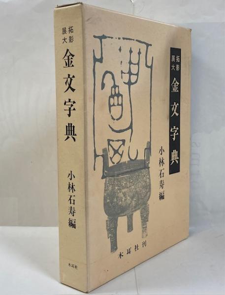
小林石寿編、木耳社、昭63、1冊
函・帯イタミ・ヤケ
在庫を確認後、状態と書影、送料をメールでお知らせいたします。
☆適格請求書発行事業者:T2810607555154
学校図書館・公共機関の公費購入可能

大雲堂書店
東京都千代田区神田神保町
東京都千代田区神田神保町
¥3,500
小林石寿 編、木耳社、昭62、1冊
函、ヤケシミ A4 348
・送料について クリックポスト(厚み3cm、1kgまで)185円、レターパックプラス(4kgまで)600円、佐川急便600円から(地域、サイズにより異なります)・利用可能な発送方法の内、安価の方法で手配します。
もっと見る
著者名「小林石寿編」の検索結果
長山書店
岡山県倉敷市昭和
岡山県倉敷市昭和
¥11,000
小林石寿編、平元、1冊
函
冊子小包(ゆうメール便)・レターパック・スマートレター・ゆうパック・ヤマト宅急便・代引き等にて発送しております。
ゆうパック・ヤマト宅急便のみ日時指定が可能です。
ご入金確認後、当日または次の日の発送になります。
土曜・日曜・祝日は定休日ですので営業日発送になります。
よかばい堂
福岡県福岡市南区寺塚
福岡県福岡市南区寺塚
¥4,500
小林石寿 編、木耳社、1985.6、222p、30cm、1冊
函にヤケシミ 本体ヤケ、三方にシミ有 ページ内ヤケ
事務所の休業:土日祝 韓国・中国・香港・台湾はEMSで発送
古書 畸人堂
静岡県伊東市吉田
静岡県伊東市吉田
¥8,000
小林石寿編、木耳社、平1、1冊
函ヤケ
在庫を確認後、状態と書影、送料をメールでお知らせいたします。
☆適格請求書発行事業者:T2810607555154
学校図書館・公共機関の公費購入可能
古書 畸人堂
静岡県伊東市吉田
静岡県伊東市吉田
¥7,000
小林石寿編、木耳社、昭63、1冊
函・帯イタミ・ヤケ
在庫を確認後、状態と書影、送料をメールでお知らせいたします。
☆適格請求書発行事業者:T2810607555154
学校図書館・公共機関の公費購入可能
飯島書店
愛知県名古屋市中区千代田
愛知県名古屋市中区千代田
¥8,400
小林石寿編、木耳社、昭和58年、1
第一刷、函
送料は実費を頂戴致します。
・A4サイズまで 厚さ3㎝以内 1kg以内 クリックポスト 185円
・A4サイズまで 厚さ3㎝以内 ヤマト運輸こねこ便 420円
・A4サイズまで 4kg以内 レターパックプラス 600円 またはヤマト宅急便
・上記の規格を超えるもの ヤマト宅急便
実際の送料は、送料・金額確定メールにてご確認ください。
長島書店〈神保町店〉
東京都千代田区神田神保町
東京都千代田区神田神保町
¥4,000
小林石寿編、木耳社、1989、1
函ヤケ・キズ有・薄汚れ 本三方薄シミ
<神保町店>の在庫は倉庫にて管理しております。店頭でご覧になりたい本がある場合は本サイトで注文時に「来店希望」のメッセージを入れていただくか、事前にメールまたは電話でお知らせください。
※代金引換について
代金引換をご希望の方は、お手数ですが「振込、代引など」を選択後、メッセージ欄にて「代金引換」とお知らせください、代金引換は郵便のみで郵便送料に代引き手数料が代金五万円未満¥533. 五万円以上¥753.加算されます。
瑞光堂
愛知県江南市村久野町河戸
愛知県江南市村久野町河戸
¥6,000
(送料:¥0~)
小林石寿編、木耳社、昭和60年
第1刷 函ヤケ・汚れ・イタミ 本体シミ 送料込
代引・海外発送不可 公費購入は3000円以上のご注文で後払い可


瑞光堂
愛知県江南市村久野町河戸
愛知県江南市村久野町河戸
¥5,000
(送料:¥820~)
小林石寿編、木耳社、1989年
第1刷 函ヤケ・汚れ 本体シミ、623・624頁角折れ・破れ
代引・海外発送不可 公費購入は3000円以上のご注文で後払い可
古書ニイロク
東京都大田区西蒲田
東京都大田区西蒲田
¥3,000
(送料:¥810~)
小林石寿 編、木耳社、1989、ゆうパック60
第1刷 函ヤケスレ・イタミ 本体薄ヤケ シミ 背黒に銀字
【御注文は必ず日本の古本屋サイト内からでお願い致します。電話・メール・FAXでの御注文は対応致しかねます。】
【商品状態等基本的に記載の通りです。全て倉庫在庫のため質問等はご遠慮願います。】
古書ワルツ
東京都青梅市成木8-33-
東京都青梅市成木8-33-
¥7,700
小林石寿編、木耳社、昭和58、1
函少キズ有。他、良好。初版。定価12000円。灰色函。厚本。
★送料について ①800グラム未満 : ゆうメールもしくはゆうパケット (300円)※(800グラム以下の場合でも3センチを超える場合はレターパック600での発送となります)。/② 800グラム以上はレターパック600 (600円) /③ ゆうパック 1箱 (880円):④(北海道、四国、山口、九州)は 1箱 (1250円)
古書ワルツ
東京都青梅市成木8-33-
東京都青梅市成木8-33-
¥3,820
小林石寿編、木耳社、1989、1
大判。函日焼け有。本体表見返しに蔵書印有。他、経年並。初版。定価11650円+税。厚本。
★送料について ①800グラム未満 : ゆうメールもしくはゆうパケット (300円)※(800グラム以下の場合でも3センチを超える場合はレターパック600での発送となります)。/② 800グラム以上はレターパック600 (600円) /③ ゆうパック 1箱 (880円):④(北海道、四国、山口、九州)は 1箱 (1250円)
大雲堂書店
東京都千代田区神田神保町
東京都千代田区神田神保町
¥3,500
小林石寿編、木耳社、平1、1冊
函、ヤケシミきつめ A4 640
・送料について クリックポスト(厚み3cm、1kgまで)185円、レターパックプラス(4kgまで)600円、佐川急便600円から(地域、サイズにより異なります)・利用可能な発送方法の内、安価の方法で手配します。
大雲堂書店
東京都千代田区神田神保町
東京都千代田区神田神保町
¥3,500
小林石寿 編、木耳社、昭62、1冊
函、ヤケシミ A4 348
・送料について クリックポスト(厚み3cm、1kgまで)185円、レターパックプラス(4kgまで)600円、佐川急便600円から(地域、サイズにより異なります)・利用可能な発送方法の内、安価の方法で手配します。
瑞光堂
愛知県江南市村久野町河戸
愛知県江南市村久野町河戸
¥6,800
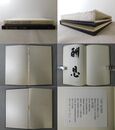
小林石寿編、木耳社、1989年
第5刷 函ヤケ・汚れ・少破れ・擦れ・地少キズ 本体少シミ・薄汚れ・少イタミ
代引・海外発送不可 公費購入は3000円以上のご注文で後払い可
大雲堂書店
東京都千代田区神田神保町
東京都千代田区神田神保町
¥3,000
小林石寿編、木耳社、平1、1冊
甲骨・金文・古?文・小篆・印篆 函 5刷、シミ汚れ、函汚れ・スレ A5
・送料について クリックポスト(厚み3cm、1kgまで)185円、レターパックプラス(4kgまで)600円、佐川急便600円から(地域、サイズにより異なります)・利用可能な発送方法の内、安価の方法で手配します。
南陽堂書店
北海道札幌市北区北8条西5丁目
北海道札幌市北区北8条西5丁目
¥5,500
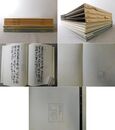
小林石寿 編、木耳社、1989、28, 640p、31cm
函ヤケ少シミ 本三方薄ヨゴレ、本体空白部分に墨ヨゴレ少しあり
◆【送料について】ネコポス,クリックポスト210円(1㎏3cm以内)・日本郵便レターパックプラス600円/レターパックライト430円・宅配便(配送地域,重さ,サイズによって配送料が異なります)◆適格請求書発行事業者です。公費でご購入の場合は必要書類等ご指示を添えてお申込みください◆領収書等の書類が必要なお客様は、ご注文時に宛名等必要事項含めご連絡ください◆店頭にてお受取をご希望の場は、前日までにメール・お電話にてご連絡をお願い致します
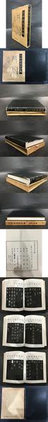
五体篆書字典 甲骨・金文・古ジ文・小篆・印篆/近代篆刻字典 の2冊
古書ワルツ
東京都青梅市成木8-33-
東京都青梅市成木8-33-
¥5,100
小林石寿編/中西庚南編、木耳社/東京堂出版、昭和58/昭和60、2
函日焼け、スレ、少ヨゴレ有。(近代篆刻字典)にビニールカバー。本体経年良好。初版。定価合計:19000円。灰色/白色函。厚本。
★送料について ①800グラム未満 : ゆうメールもしくはゆうパケット (300円)※(800グラム以下の場合でも3センチを超える場合はレターパック600での発送となります)。/② 800グラム以上はレターパック600 (600円) /③ ゆうパック 1箱 (880円):④(北海道、四国、山口、九州)は 1箱 (1250円)
もっと見る
書誌カタログから探す
「日本の古本屋」では、書籍ごとの基本情報を「書誌カタログ」にまとめております。書誌カタログからは欲しい本のリクエストが可能です。
お探しの本が「日本の古本屋」に追加された場合に自動通知をお送りさせていただきます。

-
リクエストを送る
-
書籍情報で在庫を検索
もっと見る
光和書房の新着書籍

光和書房
東京都千代田区神田小川町3-22-9 タイメイビル2F
東京都千代田区神田小川町3-22-9 タイメイビル2F
¥154,000
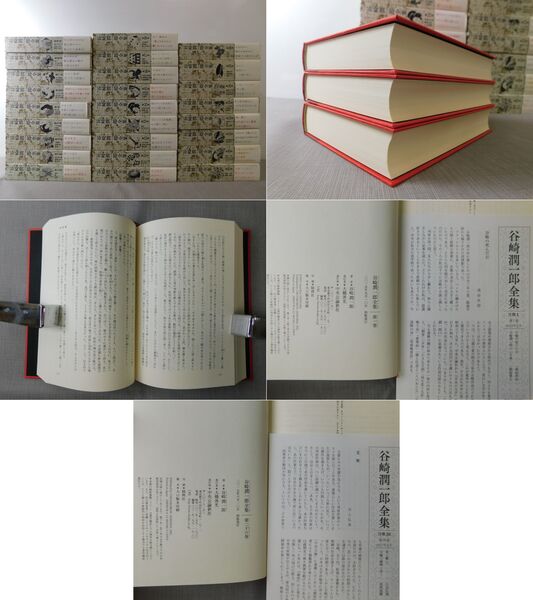
谷崎潤一郎、中央公論新社、2015、26冊
帯・月報付 函・カバー・三方・本文良好 A5【佐川飛脚宅配便160サイズで発送】
登録書籍に「書影」文字がある場合は、「書影」文字をクリックすると大きい画像で書籍を確認できます。 スマホ閲覧の場合は、PC版サイトに変更の上、「書影」文字をクリックして画像詳細をご確認ください。
厚み3cm以下の商品は送料400円~です、それ以上の商品は佐川急便、全国(離島を除く)900円~です。 海外発送も対応致します。 現品確認をご希望される場合、ご連絡を頂いた上、対応致します。
**********
ご探究の中文書などがございましたら、気軽にご連絡ください、お探し致します。

光和書房
東京都千代田区神田小川町3-22-9 タイメイビル2F
東京都千代田区神田小川町3-22-9 タイメイビル2F
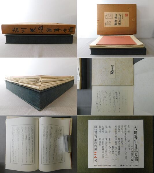
¥9,900
吉川英治著、和田芳恵解説、講談社、1972、1冊
限定300部の内112号 解説付 二重函 外函ヤケ・イタミ・書名記入 紙ケースシミ 本文良好 大判【佐川飛脚宅配便80サイズで発送】
登録書籍に「書影」文字がある場合は、「書影」文字をクリックすると大きい画像で書籍を確認できます。 スマホ閲覧の場合は、PC版サイトに変更の上、「書影」文字をクリックして画像詳細をご確認ください。
厚み3cm以下の商品は送料400円~です、それ以上の商品は佐川急便、全国(離島を除く)900円~です。 海外発送も対応致します。 現品確認をご希望される場合、ご連絡を頂いた上、対応致します。
**********
ご探究の中文書などがございましたら、気軽にご連絡ください、お探し致します。
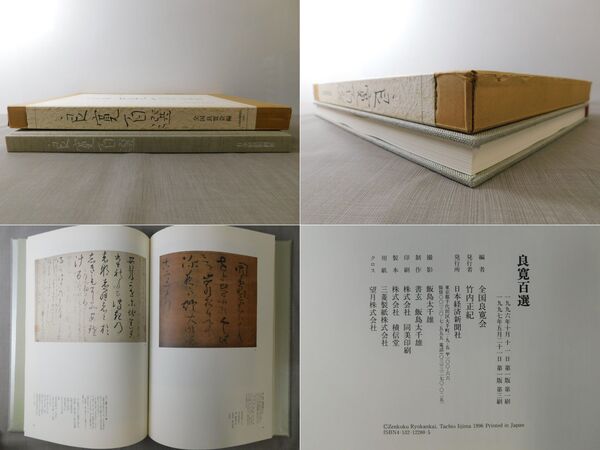
光和書房
東京都千代田区神田小川町3-22-9 タイメイビル2F
東京都千代田区神田小川町3-22-9 タイメイビル2F
¥8,800
全国良寛会、日本経済新聞社、1997、1冊
函少ヨゴレ カバー・三方・本文良好 大判【佐川飛脚宅配便80サイズで発送】
登録書籍に「書影」文字がある場合は、「書影」文字をクリックすると大きい画像で書籍を確認できます。 スマホ閲覧の場合は、PC版サイトに変更の上、「書影」文字をクリックして画像詳細をご確認ください。
厚み3cm以下の商品は送料400円~です、それ以上の商品は佐川急便、全国(離島を除く)900円~です。 海外発送も対応致します。 現品確認をご希望される場合、ご連絡を頂いた上、対応致します。
**********
ご探究の中文書などがございましたら、気軽にご連絡ください、お探し致します。
光和書房
東京都千代田区神田小川町3-22-9 タイメイビル2F
東京都千代田区神田小川町3-22-9 タイメイビル2F
¥9,000
日本国際問題研究所中国部会、日本国際問題研究所、1981、5冊
裸本 除籍本 印有 カバーヨゴレ・貼り付 三方少ヨゴレ 扉に鉛筆書込み少 本文少貼り付 A5【佐川飛脚宅配便80サイズで発送】
登録書籍に「書影」文字がある場合は、「書影」文字をクリックすると大きい画像で書籍を確認できます。 スマホ閲覧の場合は、PC版サイトに変更の上、「書影」文字をクリックして画像詳細をご確認ください。
厚み3cm以下の商品は送料400円~です、それ以上の商品は佐川急便、全国(離島を除く)900円~です。 海外発送も対応致します。 現品確認をご希望される場合、ご連絡を頂いた上、対応致します。
**********
ご探究の中文書などがございましたら、気軽にご連絡ください、お探し致します。

光和書房
東京都千代田区神田小川町3-22-9 タイメイビル2F
東京都千代田区神田小川町3-22-9 タイメイビル2F
¥4,000
現代中国研究部会、セプレス、1973、2冊
裸本 除籍本 印有 カバーヨゴレ・貼り付 三方少シミ 扉に鉛筆書込み少 A5【佐川飛脚宅配便60サイズで発送】
登録書籍に「書影」文字がある場合は、「書影」文字をクリックすると大きい画像で書籍を確認できます。 スマホ閲覧の場合は、PC版サイトに変更の上、「書影」文字をクリックして画像詳細をご確認ください。
厚み3cm以下の商品は送料400円~です、それ以上の商品は佐川急便、全国(離島を除く)900円~です。 海外発送も対応致します。 現品確認をご希望される場合、ご連絡を頂いた上、対応致します。
**********
ご探究の中文書などがございましたら、気軽にご連絡ください、お探し致します。

光和書房
東京都千代田区神田小川町3-22-9 タイメイビル2F
東京都千代田区神田小川町3-22-9 タイメイビル2F
¥25,000
立木義浩撮影、新潮社、1983、1冊
緒形拳宛署名入り カバーふち少イタミ 三方・本文良好 大判【佐川飛脚宅配便80サイズで発送】
登録書籍に「書影」文字がある場合は、「書影」文字をクリックすると大きい画像で書籍を確認できます。 スマホ閲覧の場合は、PC版サイトに変更の上、「書影」文字をクリックして画像詳細をご確認ください。
厚み3cm以下の商品は送料400円~です、それ以上の商品は佐川急便、全国(離島を除く)900円~です。 海外発送も対応致します。 現品確認をご希望される場合、ご連絡を頂いた上、対応致します。
**********
ご探究の中文書などがございましたら、気軽にご連絡ください、お探し致します。

光和書房
東京都千代田区神田小川町3-22-9 タイメイビル2F
東京都千代田区神田小川町3-22-9 タイメイビル2F
¥11,000
大溪洗耳、日本教育書道芸術院、1982、4冊
函ヤケ・イタミ 三方シミ 扉シミ 本文良好 大判【佐川飛脚宅配便80サイズで発送】
登録書籍に「書影」文字がある場合は、「書影」文字をクリックすると大きい画像で書籍を確認できます。 スマホ閲覧の場合は、PC版サイトに変更の上、「書影」文字をクリックして画像詳細をご確認ください。
厚み3cm以下の商品は送料400円~です、それ以上の商品は佐川急便、全国(離島を除く)900円~です。 海外発送も対応致します。 現品確認をご希望される場合、ご連絡を頂いた上、対応致します。
**********
ご探究の中文書などがございましたら、気軽にご連絡ください、お探し致します。

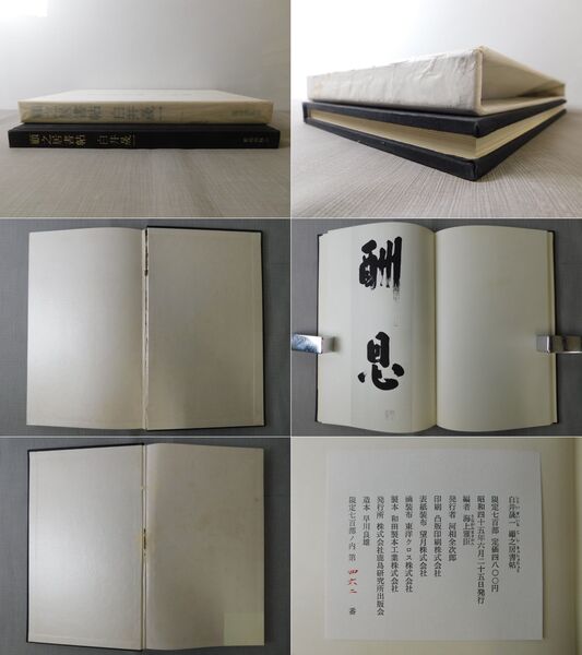
光和書房
東京都千代田区神田小川町3-22-9 タイメイビル2F
東京都千代田区神田小川町3-22-9 タイメイビル2F
¥15,000
白井晟一、鹿島研究所出版会、1970、1冊
限定700部うち462番 函・カバー少ヨゴレ ノドワレ有 見返し頁切れ A4変形【佐川飛脚宅配便60サイズで発送】
登録書籍に「書影」文字がある場合は、「書影」文字をクリックすると大きい画像で書籍を確認できます。 スマホ閲覧の場合は、PC版サイトに変更の上、「書影」文字をクリックして画像詳細をご確認ください。
厚み3cm以下の商品は送料400円~です、それ以上の商品は佐川急便、全国(離島を除く)900円~です。 海外発送も対応致します。 現品確認をご希望される場合、ご連絡を頂いた上、対応致します。
**********
ご探究の中文書などがございましたら、気軽にご連絡ください、お探し致します。