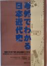
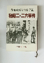
Dr. Alois Geistbeck、Bibliographisches Institut、c. ・・・
A vintage German pictorial atlas, Bilder-Atlas zur Geographie der aussereuropäischen Erdteile (c. 1897–1905), by Dr. Alois Geistbeck, published by Bibliographisches Institut, Leipzig and Vienna. Focused on non-European continents, it features 314 woodcut and engraved illustrations of landscapes, cities, indigenous peoples, and wildlife from Asia (including Japan), Africa, the Americas, Australia (Platypus, Emu), and the South Polar Regions, printed in German Fraktur. Original decorative grey cloth with Art Nouveau blocking. Condition: Grade C shelf wear, rubbed corners and spine ends, soiled exterior; interior pages yellowed but clean, binding sound. A valuable resource for historical geography and antique illustration collectors.
◆送料:別途ご負担いただきます。在庫確認後、メールにてお知らせいたします。
◆送料目安:
・単行本(900g以内・厚さ2.5cm以内): 300円(税込)
・単行本(1kg以上):レターパックライト 430円(税込)/レターパックプラス 600円(税込)
・大型本:ゆうパックまたは佐川急便(サイズ合計60cm~170cm/800円~2000円(税込))


![ポケットモンスター 幻のポケモン ルギア爆誕【劇場版】 [VHS]](https://www.kosho.or.jp/upload/save_image/36000750/12030156_692f1a523d474.jpg)