![]()
文字サイズ
全ニッポン古本博覧会 - 古本、古書を愉しむ
月の世
¥700,000
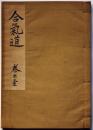
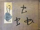
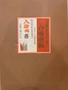
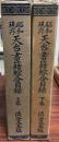
限定版 秘伝 合氣道 巻之壹 昭和29年 謄写版 植芝康悦著
¥150,000
杉山寧 (銅版画「石山」入・限66部内60番本) カラーメゾチント入
¥298,000
ヰルヤム・ブレイク書誌 識語入り
¥440,000
特装版 手彩色素描二葉入 平山郁夫画集 西から東へ
¥120,000
真昼のレモン
¥300,000
夢の博物館 限定版
¥93,500
302 MOONFIRE Limited edition サイン入り
¥450,000
いまはむかし :異装本限定23部
¥95,000
限定版 日本相撲史 上・中卷 2冊
¥132,000
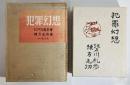
犯罪幻想 200部限定 毛筆署名入 棟方志功手摺木版画11葉挿入
¥500,000
七つのリトグラフ 池田満寿夫・オリジナル版画集
¥165,000
ヰルヤム・ブレイク書誌 署名本
¥165,000
宮田三郎木版画集 番外 続信州 (二十景)
¥200,000
剣持勇の世界 その結晶の核ー作品 限定千部番号入り全5分冊
¥165,000
黄龍硯斎 園田穆鑑蔵 周秦古璽印譜
¥440,000
古今紙漉紙屋図絵 上・下 2冊
¥220,000
詩集 忘魚の歌
¥220,000
のりものゑほん
¥95,000
国宝 雪舟筆 山水長巻 「紙本墨画淡彩四季山水画」
¥88,000
三半規管喪失
¥330,000
野戦給養必携
¥50,000
後奈良天皇宸翰 紺紙金泥般若心経
¥99,000
真昼のレモン
¥150,000
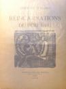
ユビュおやじの再生 REINCARNATIONS DU PERE ...
¥1,782,000
書物 特装限定版
¥120,000
続 どの本よもうかな? 1900冊
¥1,360
中國古印圖録 大谷大学所蔵禿庵文庫
¥110,000

【上村松園】「鼓の音」限定180部 承認印・エディション入り
¥165,000
【限定230部・シリアル入】二合庵遊戯 小島寅雄 署名落款入
¥132,000
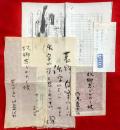
司馬遼太郎書簡 直筆題名:故郷忘じがたく候
¥180,000
戦艦武蔵 正続
¥120,000
コルボオ叢書
¥198,000
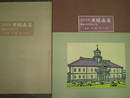
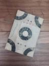
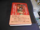
![時代椀大観 第1輯 [復刻版]](https://www.kosho.or.jp/upload/save_image/12010130/20220601120812301776_65944ba336deec99df94e701a187c2b2.jpg)
時代椀大観 第1輯 [復刻版]
¥143,000
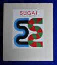
SUGAI 菅井汲 特装本
¥99,000
有元利夫全作品 1973~1984 限定版 版画入
¥132,000
kosho.or.jpドメイン取得30年 - 古本とインターネット
東京組合五十年史 (初版)
¥900
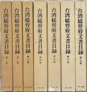
台湾総督府文書目録 1~7巻
¥49,500
昭和現存天台書籍綜合目録 上・下巻 (2冊)
¥59,800
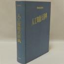
人工知能大辞典
¥6,600
日本古書通信 創刊号~146号のうち124冊
¥66,000
古美術品図録一~四・大典記念京都博覧会第三会場陳列品総目 揃
¥49,500
大阪古書組合百年史
¥8,000
山田伯爵家文書 全7巻+総目録 計8冊揃
¥46,000
ネットワーカーが世界を変える
¥3,050
除籍本 人工知能における知識ベースシステム
¥5,500
足利学校秘籍叢刊 重文 毛詩註疏 揃
¥66,000
大武鑑 巻1~5+索引 改訂
¥66,000
第壹回全國昆蟲展覽會 出品目録 昆蟲叢書第壹編
¥77,000
古典籍総合目録
¥3,000
東京古書組合五十年史
¥5,880
20世紀のポスター
¥2,000
認知科学辞典
¥5,500
ペンタゴンの頭脳 <ヒストリカル・スタディーズ 19>
¥3,560
中国の広告とインターネットの実態
¥3,990

敦煌道経 目録・図録編 全2冊揃い
¥88,000
交差する日台戦後サブカルチャー史
¥2,500
殷周青銅器綜覧 3 春秋戦国時代青銅器之研究 全2冊
¥82,500
ASCII DOS / V ISSUE 創刊号
¥3,050
仏書解説大辞典 別巻・著者別書名目録共 全15冊 改訂5刷
¥55,000

日本情報通信史事典―トピックス1854-2022
¥14,960
サイバーパンクハンドブック 日本版
¥6,800
20世紀のポスター「タイポグラフィ」
¥4,300
電脳都市 SFと未来コンピュータ
¥500
月刊アスキー ASCII 49~240号
¥179,300
昭和現存天台書籍綜合目録 上下増補版 索引欠
¥40,000
人工知能学事典
¥11,000

書誌書目シリーズ47 満鉄大連図書館蔵書目録 全20巻
¥550,000

ウェブ進化論
¥220