![]()
文字サイズ


キーワード「MAP」の検索結果


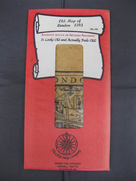
Old map of London 1593 Authentic Replica on Antiqued Parchment
氷川書房
東京都葛飾区青戸
東京都葛飾区青戸
¥1,320
The Old Map Company、刊年不明
38×50cm 袋付き 状態:並
【水曜日・土曜日定休】
国税庁適格請求書発行事業者番号
T2810722326225


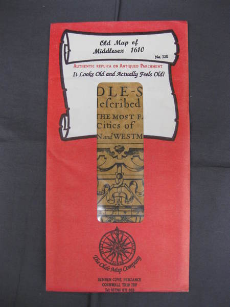
Old map of Middlesex 1610 Authentic Replica on Antiqued Parchment

氷川書房
東京都葛飾区青戸
東京都葛飾区青戸
¥1,320
The Old Map Company、刊年不明
未開封 袋付き 状態:並
【水曜日・土曜日定休】
国税庁適格請求書発行事業者番号
T2810722326225
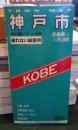
神戸市 <Town map 兵庫県> <Town map 兵庫県>
古本はてなクラブ
東京都小金井市貫井北町
東京都小金井市貫井北町
¥1,100
日地、地図 2枚 : 色刷、53×74-62×87cm (折りたたみ21cm)
ケース擦れ、小キズ・Mapは角に折れ痕、日焼け、シミ箇所あります。梱包丁寧、迅速に東京都小金井市から発送します。
ご入金確認またはご決済後に発送します。
日本全国・送料・300円~ 宅急便800円~ ヤマト運輸・日本郵便利用
(本の形状と重さによります。より安全・安価な発送方法にて、そのつどお知らせいたします。)
お買い上げ2万円以上で送料サービスいたします。
なお代引き発送はしていません。

ビーバーズブックス
北海道札幌市中央区南十七条西8丁目1-32
北海道札幌市中央区南十七条西8丁目1-32
¥1,500
小林伸一郎 著、イースト・プレス、2003、159p、29cm
[B+] 帯付一刷、カバー微スレ・ほかは問題なし良好です
・単品スピード注文いただければ早期発送可能です。
・複数購入は別途お見積りとなります。代金は基本的に「先払い」となります(公費購入は別途対応有)。
・クレジット決済または振込頂いてから2営業日以内に出荷いたします。代引きは取扱しておりません。
トラブルのないお取引を目指しております。よろしくお願いします。
不死鳥BOOKS
岡山県総社市駅前
岡山県総社市駅前
¥2,260
(送料:¥600~)
河合良訓 監修 ; 原島広至 著、エヌ・ティー・エス、CD-ROM 1枚、12cm
CD-ROM、骨単MAP12枚、ケースのセットです。CD盤面に多少のキズがあります。
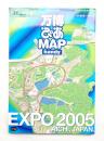
万博ぴあMAP : ハンディ <ぴあMOOKS中部 万国博関連資料>
パージナ
東京都中央区日本橋富沢町4-6 Core-46 Bldg.
東京都中央区日本橋富沢町4-6 Core-46 Bldg.
¥1,100
ぴあ中部支局、2005、97p、A5判、1冊
初版
愛・地球博会場案内MAP(折込)
特集 3分でわかる?万博気になるピックアップ12
愛・地球博ぴあMAP
パビリオン紹介
企業館
外国館
万博レストランガイド
万博アクセスガイド
愛・地球博会場案内MAP(折込)
特集 3分でわかる?万博気になるピックアップ12
愛・地球博ぴあMAP
パビリオン紹介
企業館
外国館
万博レストランガイド
万博アクセスガイド

福寿屋
大阪府豊中市玉井町
大阪府豊中市玉井町
¥600
(送料:¥185~)
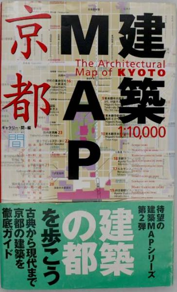
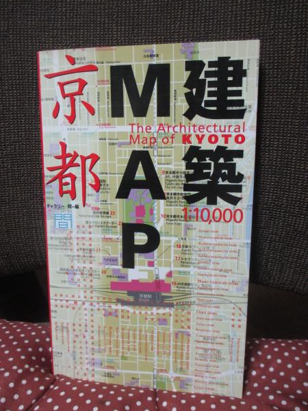
ギャラリー・間 編、TOTO、平成10年1998年、289p、26cm
平成10年1998年初版2刷
帯付き
本文は概ね良好です。
通読は問題ございません。
防水梱包でお届けします
送料別途
国内 クリックポスト 185円
帯付き
本文は概ね良好です。
通読は問題ございません。
防水梱包でお届けします
送料別途
国内 クリックポスト 185円
クリーニングとアルコール消毒をしてお届けします。
キクオ書店
京都府京都市中京区河原町通三条上ル恵比須町
京都府京都市中京区河原町通三条上ル恵比須町
¥66,000
RUSCELLI(G.)、Venice,、ca. 1574
16.5 x 23.5cm, Italian text on verso, a map in Ptolemy's Geographia.
★掲載品の大半は店頭に置いておりません。ご来店前にお問合せ下さい。★クリックポスト/レターパック/宅急便/ゆうパックから最安価な方法をご案内します。代金引換・店頭渡しをご希望の方はご注文時にご連絡下さい。置き配指定不可。
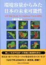
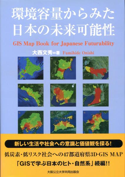
環境容量からみた日本の未来可能性 : 低炭素・低リスク社会への47都道府県3D-GIS MAP
南陽堂書店
北海道札幌市北区北8条西5丁目
北海道札幌市北区北8条西5丁目
¥1,540
大西文秀 著、大阪公立大学共同出版会、2011、184p、27cm、1冊
カバー、帯付、状態良好で中も綺麗です
◆【送料について】クリックポスト210円(1㎏3cm以内)・日本郵便レターパックプラス600円/レターパックライト430円・宅配便(配送地域,重さ,サイズによって配送料が異なります)◆適格請求書発行事業者です。公費でご購入の場合は必要書類等ご指示を添えてお申込みください◆領収書等の書類が必要なお客様は、ご注文時に宛名等必要事項含めご連絡ください◆店頭にてお受取をご希望の場は、前日までにメール・お電話にてご連絡をお願い致します
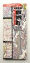
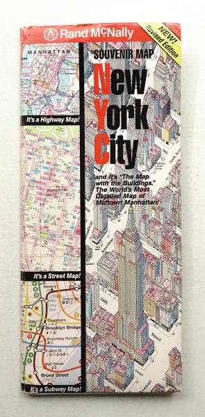
パージナ
東京都中央区日本橋富沢町4-6 Core-46 Bldg.
東京都中央区日本橋富沢町4-6 Core-46 Bldg.
¥3,300
The Manhattan Map Co.、Rand McNally ; The Manhattan・・・
改訂版、文 : 英語
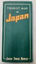
金沢書店
東京都中野区東中野
東京都中野区東中野
¥3,300
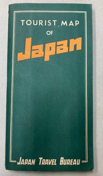
JAPAN TRAVEL BUREAU、昭27、1枚
74×102cm 再版 折り畳み 1ヶ所少裏打ち補修
発送はできるだけ安く確実に! ◆代引き決済をご希望の際は備考欄に「代引き発送希望」とお書き添えください。代引きはゆうパックとゆうメールを使用します ☆適格請求書発行事業者登録済
(株)馬燈書房 海老名支店
神奈川県海老名市門沢橋
神奈川県海老名市門沢橋
¥500
(送料:¥350~)
新創社 編、光村推古書院、~2cm、1
【単品スピード注文推奨】
クレジットやキャリア決済でのご注文は単品スピード注文でご注文していただけると速やかに発送できます。
【同梱ご希望の方はまとめてご注文お願いします】
別注文の同一梱包はお受けできかねます。複数冊ご注文の際は一度にまとめてカートに入れてご注文いただけますと幸いです。
※配送拠点が異なりますため、「(株)馬燈書房」で販売されている商品との同梱はお受けいたしかねます。
Wainwright Maps of the Lakeland Fells Map 1 <Wainwright maps (of the Lakeland Fells)>
古書 往来座
東京都豊島区南池袋
東京都豊島区南池袋
¥2,500
(送料:¥300~)
By (author) Wainwright, Alfred、Chop McKean Mapping・・・
【1997年】保存状態:良好(目立たない僅かなスレやヤケなどがあるものの総合的に良い)
★送料は価格の右に表示されている額です(「〜」は無意味です)★公費でのご購入の際は必ず商品詳細ページの「書籍の購入について」をご確認くださいませ

Wainwright Maps of the Lakeland Fells Map 1 <Wainwright maps (of the Lakeland Fells)>
¥2,500
(送料:¥300~)

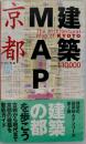
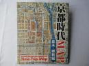
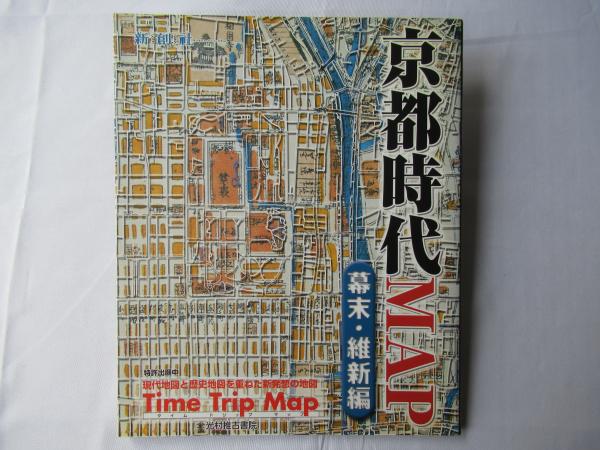
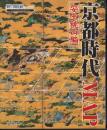
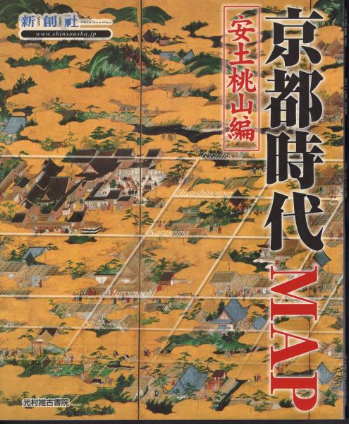
京都時代map 幕末・維新編 <Time trip map>
古書 思い出の歴史
青森県青森市本町
青森県青森市本町
¥750
(送料:¥185~)
新創社 編、光村推古書院、80p、26cm
擦り傷、よれ、汚れ、ヤケ、使用感
単品スピード注文の場合は、発送連絡のみとさせて頂きます。
上記以外は、注文メールを頂いてから、在庫確認をした後、折り返しご連絡させて頂きます。
※なるべく24時間以内を目指しますが、定休日や臨時休業の場合にはもう少しお時間掛かります。
※送料確定後72時間以内にお支払いが無い場合は取引中止とさせて頂きます。
<配送事故に関しましては、個別に対応させて頂きます。>
メールアドレス<omoreki2016@ymail.ne.jp>
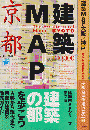
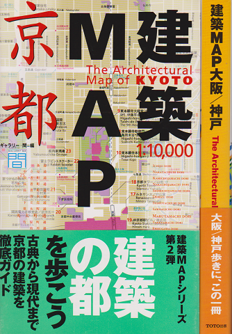
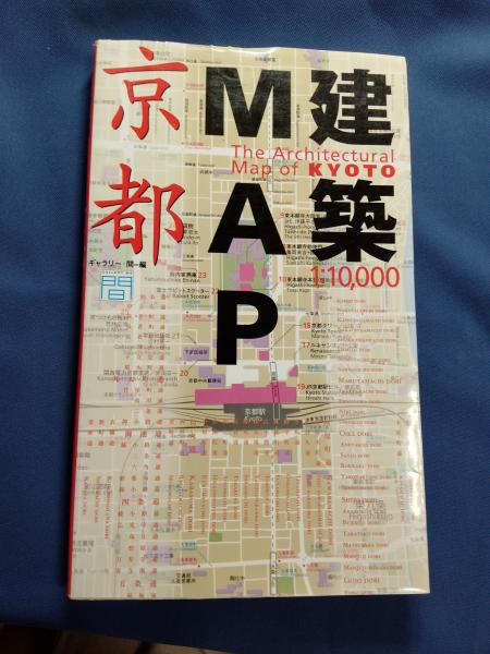
かもがわ書店
京都府京都市北区小山西大野町
京都府京都市北区小山西大野町
¥500
(送料:¥300~)
ギャラリー・間 編、TOTO、431p、26cm
カバー小傷ややヤケ色褪せ 本文概ね良好 送料300円
★書込み等がある場合は解説に載せています(発送前に再度検品します)
★代金先払いです(一週間以内にお振込下さい)
★送料:(A4サイズ・厚さ3cm・重量1kgまで)ゆうメール300円 (上記以外で重量3kgまで)レターパック専用封筒に入るもの 600円 入らないもの 定形外郵便(規格外)~1330円 (重量3kg超)ゆうパック1200円(北海道、沖縄は1500円)
★かもがわ書店内の書籍検索は、店舗情報の「かもがわ書店」をクリックしてください

MAGNAE TARTARIAE, Magni Mogolis Imprerii, Japoniae et Chinae, Nova Descriptio. [map]
キクオ書店
京都府京都市中京区河原町通三条上ル恵比須町
京都府京都市中京区河原町通三条上ル恵比須町
¥253,000
WIT(Frederick de)、Amsterdam,、ca. 1680
43.5 x 55cm, copper-engraving, hand-coloured outline, English notes by pen, on verso 'Western Tartariae' drawing map by pen.
★掲載品の大半は店頭に置いておりません。ご来店前にお問合せ下さい。★クリックポスト/レターパック/宅急便/ゆうパックから最安価な方法をご案内します。代金引換・店頭渡しをご希望の方はご注文時にご連絡下さい。置き配指定不可。
星尾ブックシェルフ
群馬県甘楽郡南牧村星尾
群馬県甘楽郡南牧村星尾
¥25,460
Cooper, T.T.、John Murray、1871
xiv, 471p Blue Cloth Illus. fold out map G+(covers rubbed/map repaired but complete)
TRAVELS OF A PIONEER OF COMMERCE IN PIGTAIL & PETTICOATS; OR, AN OVERLAND JOURNEY FROM CHINA TOWARDS INDIA.
¥25,460
ILLUSTRATED GUIDE TO KYOTO & ITS SUBURBS, with Map an Entirely New Work.
キクオ書店
京都府京都市中京区河原町通三条上ル恵比須町
京都府京都市中京区河原町通三条上ル恵比須町
¥27,500
YOSHII(Tsunetarou), LUDLOW(J.P.)(reviced)、Osaka Na・・・
56p., 9 x 12.5cm, oblong, a folding map, 17 colour woodcuts, Japanese binding rubbed, stained.
★掲載品の大半は店頭に置いておりません。ご来店前にお問合せ下さい。★クリックポスト/レターパック/宅急便/ゆうパックから最安価な方法をご案内します。代金引換・店頭渡しをご希望の方はご注文時にご連絡下さい。置き配指定不可。
PANORAMA DES RHEINS von Mainz bis Coln. [map]
キクオ書店
京都府京都市中京区河原町通三条上ル恵比須町
京都府京都市中京区河原町通三条上ル恵比須町
¥88,000
DELKESKAMP(J.W.)、Frankfurt, Wilmans,、1825
binding with boards mounted original title piece, folding engraved map: 228 x 22cm, repaired, Text: 14p. Leaflet: 16p., 18cm, damaged.
★掲載品の大半は店頭に置いておりません。ご来店前にお問合せ下さい。★クリックポスト/レターパック/宅急便/ゆうパックから最安価な方法をご案内します。代金引換・店頭渡しをご希望の方はご注文時にご連絡下さい。置き配指定不可。
The Vinland Map and the Tartar Relation
氷川書房
東京都葛飾区青戸
東京都葛飾区青戸
¥11,000
R.A.Skelton, Thomas E.Marston, and George D.Painte・・・
30X23cm カバ 291頁 状態:並
【水曜日・土曜日定休】
国税庁適格請求書発行事業者番号
T2810722326225
HISTORY OF THE INSURRECTION IN CHINA.
星尾ブックシェルフ
群馬県甘楽郡南牧村星尾
群馬県甘楽郡南牧村星尾
¥15,270
Callery, M.M. & Yvan、Harper & Brothers、1853
viii, 301p, 6p Purple embossed cloth Fold out map, frontis. VG(蔵書票/spine faded/text some foxed/map repaired)
キクオ書店
京都府京都市中京区河原町通三条上ル恵比須町
京都府京都市中京区河原町通三条上ル恵比須町
¥44,000
PURCHAS(S.)、London,、ca. 1624
15 x 18.5cm, in English text leaf, English text on verso, a map in 'Purchas his Pilgrime' and from Mercator/Hondius Atlas.
★掲載品の大半は店頭に置いておりません。ご来店前にお問合せ下さい。★クリックポスト/レターパック/宅急便/ゆうパックから最安価な方法をご案内します。代金引換・店頭渡しをご希望の方はご注文時にご連絡下さい。置き配指定不可。
GENERAL MAP OF RAILROADS IN JAPAN
金沢書店
東京都中野区東中野
東京都中野区東中野
¥1,000
2001、1枚
JTB2001年「旅」3月号特別付録 復刻(昭和22年) 58×81cm
発送はできるだけ安く確実に! ◆代引き決済をご希望の際は備考欄に「代引き発送希望」とお書き添えください。代引きはゆうパックとゆうメールを使用します ☆適格請求書発行事業者登録済
大釜書店
兵庫県神戸市長田区片山町
兵庫県神戸市長田区片山町
¥400
(送料:¥185~)
ギャラリー・間 編、TOTO出版、1999、289p、26cm、1
写真掲載しているように、カバーの周縁部に、若干のヨレがあります。きれいな状態で読んでいただきたいので、OPPで透明カバーを巻いて、発送します(簡単に取れますし、本体に直接、接着しないので、跡が残ることもありません)。ご了解ください。本の中身に問題はありません。1999年発行・5刷。ページ・カバー破れ、落丁、書き込みはありません。クリックポスト(追跡可能)で、即時発送します。宜しくお願いします。
昼の12時ぐらいまでのご注文ならば、当日の発送いたします。
大体、厚さ3センチ以内なら、クリックポスト(185円・追跡可)にて発送します。厚さが3センチ以上なら、レターパック・プラス(600円・追跡可)、大型本ならば、ゆうパックを使用します。
水濡れ防止のため、ビニールを使用し、衝撃吸収のため、エアキャップで梱包します。「迅速な発送」・「丁寧な梱包」を心がけます。
氷川書房
東京都葛飾区青戸
東京都葛飾区青戸
¥2,750
(送料:¥330~)
新創社編、光村推古書院、平18
26×21cm カバ 83頁 状態:良好
【水曜日・土曜日定休】
国税庁適格請求書発行事業者番号
T2810722326225


京都時代map 幕末・維新編 <Time trip map>
はじっこブックス
東京都江戸川区南小岩
東京都江戸川区南小岩
¥800
(送料:¥300~)
新創社 編、光村推古書院、80p、26cm、1冊
ページ部分に書き込みもなく全体的に良好な状態です。**書き込み、切り抜き等のチェックは入念にしておりますが、見落とし等ある場合がございます。その場合はご連絡ください。すぐの対応に努めます。
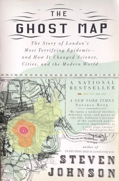
富士書房
秋田県南秋田郡八郎潟町夜叉袋字中羽立59-10
秋田県南秋田郡八郎潟町夜叉袋字中羽立59-10
¥3,000
(送料:¥185~)
Steve Johnson、Riverhead Books:New York、2007、299pp、・・・
ペーパーバック。おおむね良好な状態です。
International shipping available. 国内での発送は日本郵便、クロネコヤマト。代引きはゆうメールまたはゆうパックの送料+代引手数料468円。
(英)地図上のリトアニア〜15世紀から20世紀まで Lithuania on the map
高橋麻帆書店
石川県金沢市本多町
石川県金沢市本多町
¥4,620
[compiled by Aldona Bieliūnienė, Birutė Kulnytė, R・・・
厚紙装、カバー、良好 全頁色刷り(リトアニア周辺古地図)多数収録

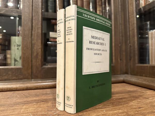
北沢書店
東京都千代田区神田神保町
東京都千代田区神田神保町
¥19,800
E. BRETSCHNEIDER、LONDON: ROUTLEDGE & KEGAN PAUL LT・・・
Reprint of New Edition (1937), original light green cloth with gilt title on spine, folding map of each frontispiece, with original jacket, complete set in 2 volumes, GOOD SET


パノラマ書房
福岡県福岡市城南区樋井川
福岡県福岡市城南区樋井川
¥400
(送料:¥360~)
ギャラリー・間:編、TOTO出版、平成21、1
11刷 B五変型 カバー・帯付 289頁 帯少スレ傷み 程度概ね良好 600g内
梱包重量とサイズにより、弊店規定の送料を別途請求させていただきます。海外は基本的にEMS発送となり、実費送料および手数料400円を加算させていただきます。パソコン操作の不得手な方のため、お電話・FAXでのご注文も承っております。(但し、不在の場合もあり。留守録頂ければ折り返します。)

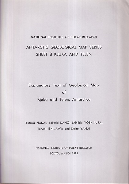
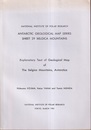
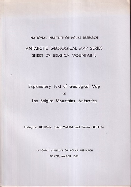
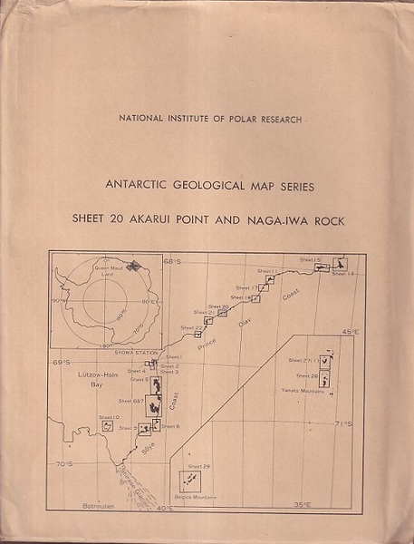
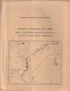
Antarctic Geological Map Series Sheet 29 Belgica Mountains <Antarctic Geological Map Series>
明倫館書店
東京都千代田区神田神保町
東京都千代田区神田神保町
¥500
National Institute of Polar Research、1981年、7、A4袋、1・・・
説明書(英文)/地質図1枚(邦文)。日焼け有、本文は概ね良好。袋イタミ有。
他サイトでも併売しておりますので売り切れの際は御了承ください。また、全ての書籍に当店の値札がございますので御了承ください。公費でお支払いをご希望の場合は商品代金合計3,000円以上でお願いいたします。通常は書籍のみの発送で書類は同封しておりません。必要書類がある方は当店の「書籍の購入について」をご覧の上、ご注文時にお問合せ欄より必要事項を事前にご連絡ください。
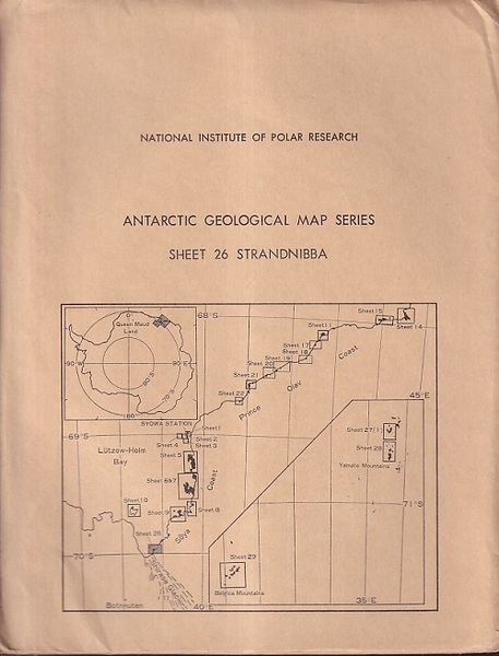
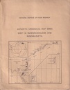
Antarctic Geological Map Series Sheet 26 Strandnibba <Antarctic Geological Map Series>
明倫館書店
東京都千代田区神田神保町
東京都千代田区神田神保町
¥500
National Institute of Polar Research、1985年、10、A4袋、・・・
説明書(英文)/地質図1枚(邦文)。日焼け有。本文は概ね良好。袋傷み有。
他サイトでも併売しておりますので売り切れの際は御了承ください。また、全ての書籍に当店の値札がございますので御了承ください。公費でお支払いをご希望の場合は商品代金合計3,000円以上でお願いいたします。通常は書籍のみの発送で書類は同封しておりません。必要書類がある方は当店の「書籍の購入について」をご覧の上、ご注文時にお問合せ欄より必要事項を事前にご連絡ください。
Antarctic Geological Map Series Sheet 10 Padda Island <Antarctic Geological Map Series>
明倫館書店
東京都千代田区神田神保町
東京都千代田区神田神保町
¥500
National Institute of Polar Research、1977年、4、A4袋、1・・・
説明書(英文)/地質図1枚(邦文)、日焼け有。本文は概ね良好。袋傷み有。
他サイトでも併売しておりますので売り切れの際は御了承ください。また、全ての書籍に当店の値札がございますので御了承ください。公費でお支払いをご希望の場合は商品代金合計3,000円以上でお願いいたします。通常は書籍のみの発送で書類は同封しておりません。必要書類がある方は当店の「書籍の購入について」をご覧の上、ご注文時にお問合せ欄より必要事項を事前にご連絡ください。
明倫館書店
東京都千代田区神田神保町
東京都千代田区神田神保町
¥500
National Institute of Polar Research、1984年、6、A4袋、1・・・
説明書(英文)/地質図1枚(邦文)。日焼け有。本文は概ね良好。袋傷み有。
他サイトでも併売しておりますので売り切れの際は御了承ください。また、全ての書籍に当店の値札がございますので御了承ください。公費でお支払いをご希望の場合は商品代金合計3,000円以上でお願いいたします。通常は書籍のみの発送で書類は同封しておりません。必要書類がある方は当店の「書籍の購入について」をご覧の上、ご注文時にお問合せ欄より必要事項を事前にご連絡ください。
明倫館書店
東京都千代田区神田神保町
東京都千代田区神田神保町
¥500
National Institute of Polar Research、1986年、11、A4袋、・・・
説明書(英文)/地質図1枚(邦文)。日焼け有。本文は概ね良好。袋傷み有。
他サイトでも併売しておりますので売り切れの際は御了承ください。また、全ての書籍に当店の値札がございますので御了承ください。公費でお支払いをご希望の場合は商品代金合計3,000円以上でお願いいたします。通常は書籍のみの発送で書類は同封しておりません。必要書類がある方は当店の「書籍の購入について」をご覧の上、ご注文時にお問合せ欄より必要事項を事前にご連絡ください。
明倫館書店
東京都千代田区神田神保町
東京都千代田区神田神保町
¥500
National Institute of Polar Research、1988年、11、A4袋、・・・
説明書(英文)/地質図1枚(邦文)。日焼け有、本文は概ね良好。袋傷み有。
他サイトでも併売しておりますので売り切れの際は御了承ください。また、全ての書籍に当店の値札がございますので御了承ください。公費でお支払いをご希望の場合は商品代金合計3,000円以上でお願いいたします。通常は書籍のみの発送で書類は同封しておりません。必要書類がある方は当店の「書籍の購入について」をご覧の上、ご注文時にお問合せ欄より必要事項を事前にご連絡ください。
Master Atlas of Greater London
ノースブックセンター
東京都八王子市越野 8-23
東京都八王子市越野 8-23
¥3,530
(送料:¥350~)
Geographers' A-Z Map Company、Geographers' A-Z Map ・・・
▼ 東京より発送 ▲ カバー:角傷み少々▲ 外観:多少使用感、スレキズ・薄汚れ・薄ヤケ少々
送料は国内地域、書籍の重量や大きさに関わらず送料一律350円頂戴しております。
※日本国外への発送は行っておりません。(発送先が海外の場合は注文キャンセルとさせていただきます。)
※郵便局留め、センター留め、コンビニ受取は指定不可となります。
AIR RAID, PEARL HARBOR. THIS IS NT DRILL The most accurate map of Pearl Harbor December 7,1941
太郎舎
長崎県西彼杵郡時津町野田郷
長崎県西彼杵郡時津町野田郷
¥1,000
A Poster Sized Map ★単品送料¥200(国内) ★画像をご参照下さい⇒ https://www.dropbox.com/s/wfuanc2p1jemn85/1581.jpg?dl=0
ご入金確認後に発送します。代金引換は致しておりません。 公費ご購入につきましてはご指示に従います。 配送料、商品画像URL未記載のものは受注確認のメールにて お知らせします。★配送料未記載のもので規格に合致するものはゆうメール正規料金に準じます。規格外のものは、重量、形状、配達域等によりそれぞれ異なります。海外のご住所はすべて英語表記にてお願いします。国外配送は国際郵便EMSを使用します。送料実費をご負担下さい。
古書ワルツ
東京都青梅市成木8-33-
東京都青梅市成木8-33-
¥1,350,000
川田喜久治、美術出版社、1965、1
函入(タトウ)。外函付(外函日焼け有)。カバー少イタミ有。本体良好。別刷「MAP 大江健三郎」付。初版。定価2000円。
★送料について ①800グラム未満 : ゆうメールもしくはゆうパケット (300円)※(800グラム以下の場合でも3センチを超える場合はレターパック600での発送となります)。/② 800グラム以上はレターパック600 (600円) /③ ゆうパック 1箱 (880円):④(北海道、四国、山口、九州)は 1箱 (1250円)

mAp The Cultural Avant Garde number 7 (technology & nature)
円錐書店
北海道札幌市中央区
北海道札幌市中央区
¥2,800
MAP Publications、1995
英文 リング製本 リングに錆あり 並
1. fashion exclusive interview:Issey Miyake, photo by Andrew Macpherson
2. technovation: new products from Sony, Panasonic, and more
3. new Alessi products
4. interview: Hideto Fuse
1. fashion exclusive interview:Issey Miyake, photo by Andrew Macpherson
2. technovation: new products from Sony, Panasonic, and more
3. new Alessi products
4. interview: Hideto Fuse
公費でのご購入も承ります。
商品の重量と形状に合わせて、最も安価な方法でお送り致します。
別途送料クリックポスト185円(梱包時34×25cm、厚3cm、1㎏以内)、レターパックライト430円(梱包時34×24.8cm、厚3cm、4㎏以内)、レターパックプラス600円もしくはゆうパックにて発送いたします。
※店頭にてお取引を希望の場合は必ず事前にご連絡ください。
MAP OF LOVE. 1ST ED. 1ST ISSUE.
北沢書店
東京都千代田区神田神保町
東京都千代田区神田神保町
¥74,800
THOMAS, D.、1939.、In 1 Vols.
The Map of Love - Verse and Prose. 116pp., portrait frontispieceof the author by Augustus John. (J.M. Dent, 1939) FIRST EDITION,FIRST ISSUE. Original cloth, with chipped dust wrapper.* First issue in fine-grained mauve cloth and with the publisher's


もっと見る
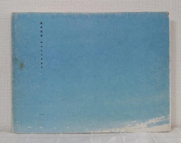
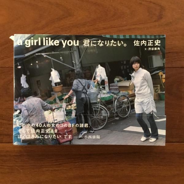
著者名「佐内正史」の検索結果

かもがわ書店
京都府京都市北区小山西大野町
京都府京都市北区小山西大野町
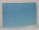
¥12,000
(送料:¥1,200~)
佐内 正史【著】、光琳社出版、1冊(ページ付なし)、23×37cm
表紙小傷ややヤケ 本文概ね良好 ゆうパック
★書込み等がある場合は解説に載せています(発送前に再度検品します)
★代金先払いです(一週間以内にお振込下さい)
★送料:(A4サイズ・厚さ3cm・重量1kgまで)ゆうメール300円 (上記以外で重量3kgまで)レターパック専用封筒に入るもの 600円 入らないもの 定形外郵便(規格外)~1330円 (重量3kg超)ゆうパック1200円(北海道、沖縄は1500円)
★かもがわ書店内の書籍検索は、店舗情報の「かもがわ書店」をクリックしてください

カモシカ書店
大分県大分市中央町
大分県大分市中央町
¥7,000
(送料:¥990~)
佐内正史写真 ; Hatanaka Akihiro編集、マッチアンドカンパニー、35×37cm
2006年発行。署名入り。
ビニールカバーに小さな破れ。
本冊は中身に書き込みなどございません。
ビニールカバーに小さな破れ。
本冊は中身に書き込みなどございません。
即決注文は、ご注文確定後、2営業日以内に発送いたします。
お振込の場合は、お振込確認後、2営業日以内に発送いたします。
頑丈な防水梱包で丁寧に発送いたします。
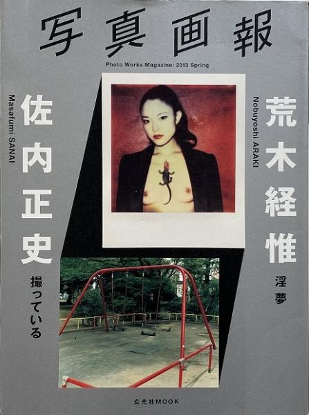
写真画報 Photo Works Magazine 2013 spring 荒木経惟 佐内正史
smokebooks(スモークブックス)
千葉県松戸市稔台1-21-1
千葉県松戸市稔台1-21-1
¥2,200
2013年 玄光社 ソフトカバー カバー付き 21x29x1
本の状態:カバー 折れ すれ 少
荒木経惟 淫夢
佐内正史 撮っている
本の状態:カバー 折れ すれ 少
荒木経惟 淫夢
佐内正史 撮っている
古書 瀧堂
東京都世田谷区松原5-27-11
東京都世田谷区松原5-27-11
¥9,000
佐内正史 [写真] ; 伊賀大介・大竹伸朗 [ほか]/ブックデザイン=町口覚、M 対照、1冊、43×・・・
写真集
限定1,000部のうち第189番
輸送箱なし
限定1,000部のうち第189番
輸送箱なし
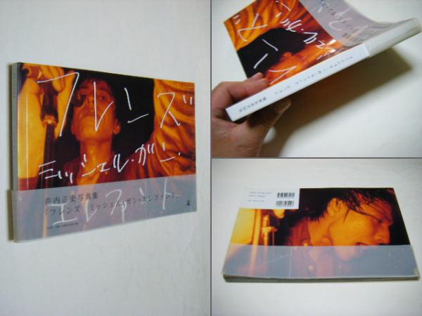
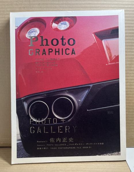
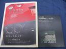
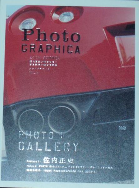
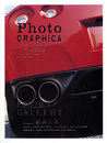
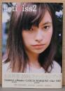
Photo GRAPHICA 2008年夏号 Vol.11 佐内正史

あまかわ文庫
兵庫県姫路市飾東町北野
兵庫県姫路市飾東町北野
¥1,400
佐内正史、MDNコーポレーション、2008年、1
古本
MDNコーポレーション 2008年 Vol.11
特集 佐内正史
駅前在庫
表紙ヤケ、表紙ヨゴレ、表紙シワ
クリックポスト(185円)で発送予定です。
MDNコーポレーション 2008年 Vol.11
特集 佐内正史
駅前在庫
表紙ヤケ、表紙ヨゴレ、表紙シワ
クリックポスト(185円)で発送予定です。

古書窟 揚羽堂
東京都大田区池上
東京都大田区池上
¥700
(送料:¥185~)
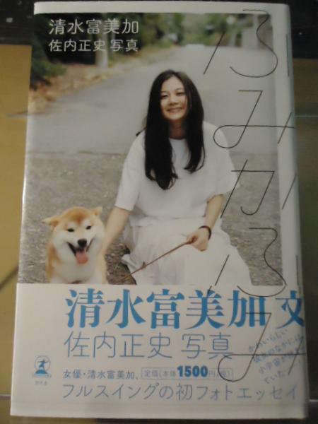
清水富美加 著 ; 佐内正史 写真、幻冬舎、2016、125p、19cm、1
初版 帯 カバーに少擦れ有り。
土日祝日は発送・連絡業務ができません。
宜しくご了承下さい。
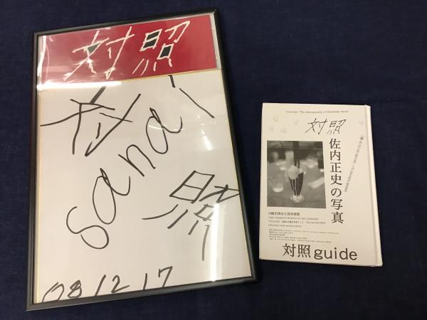
・佐内正史マジック直筆色紙「対照」 ・佐内正史個人レーベル対照DM4種 ・書籍『対照guide 佐内正史の写真』 2009年 川崎市立岡本太郎美術館
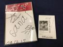
古書 往来座
東京都豊島区南池袋
東京都豊島区南池袋
¥12,000
(送料:¥800~)
<2009>色紙角に少ツブレあり 書籍の角に傷み 保存状態:並(経年の瑕疵が普通にあるがひどくはない経年並み)
★送料は価格の右に表示されている額です(「〜」は無意味です)★公費でのご購入の際は必ず商品詳細ページの「書籍の購入について」をご確認くださいませ
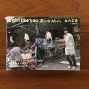
夏秋冬秋 佐内正史 Natsuakihuyuakisanaimasahumi
smokebooks(スモークブックス)
千葉県松戸市稔台1-21-1
千葉県松戸市稔台1-21-1
¥4,950
2006年 Match and Company +Sanai Office 裏表紙 エディションナンバー 署名 中綴じ 37x34
本の状態:良い
本の状態:良い
りーちあーと
大阪府大阪市北区芝田
大阪府大阪市北区芝田
¥12,000
佐内正史、対照、2009、1
カバー
初版
輸送箱付
限1000
佐内正史がパチンコ屋で「CR新世紀エヴァンゲリオンを6×7で撮影したシリーズを収録しています。
初版
輸送箱付
限1000
佐内正史がパチンコ屋で「CR新世紀エヴァンゲリオンを6×7で撮影したシリーズを収録しています。
送料は実費頂戴しておりますが、2万円以上の場合無料(海外発送・大口発送などの場合は有料)。クリックポスト、レターパック、宅配便(西濃運輸カンガルー便)など、商品のサイズや価格、送料などを勘案してご請求致しますが、ご希望があればご注文時に付記して頂ければ出来る限り、柔軟に対応致します。コンディションなどにつきましてはメールで画像をお送りしますのでお気軽にお問い合わせ下さい。

りーちあーと
大阪府大阪市北区芝田
大阪府大阪市北区芝田
¥6,000
佐内正史、マッチアンドカンパニー、2006、1
ペーパーバック
初版
署名入
佐内正史の事務所から撮影された写真6点を収録しています。
初版
署名入
佐内正史の事務所から撮影された写真6点を収録しています。
送料は実費頂戴しておりますが、2万円以上の場合無料(海外発送・大口発送などの場合は有料)。クリックポスト、レターパック、宅配便(西濃運輸カンガルー便)など、商品のサイズや価格、送料などを勘案してご請求致しますが、ご希望があればご注文時に付記して頂ければ出来る限り、柔軟に対応致します。コンディションなどにつきましてはメールで画像をお送りしますのでお気軽にお問い合わせ下さい。
百年
東京都武蔵野市吉祥寺本町
東京都武蔵野市吉祥寺本町
¥7,700
佐内正史 MASAFUMI SANAI、Sanai Masafumi Office、2003、1
※「状態」の表記に依らず解説をよくお読みいただいたうえでご注文ください
■配送 厚さや重さにあわせ、ゆうパケット250, 310, 360円、レターパック430, 600円、ゆうパック(80サイズ都内810円~)でご案内します。
■取り置き 店舗で受取希望の場合はご来店予定日をお知らせください。
■公費 ご注文承ります。必要書類・お支払い時期をお知らせください。
■営業時間 12時から20時 火曜定休
◆International shipping OK!◆
買取お気軽にご相談ください。
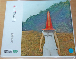
ビーバーズブックス
北海道札幌市中央区南十七条西8丁目1-32
北海道札幌市中央区南十七条西8丁目1-32
¥8,500
(送料:¥430~)
佐内正史 MASAFUMI SANAI、平凡社、2001、1冊 (ページ付なし)、24×31cm
C+ 一刷、カバーイタミ(全体にコスレ、角剥げ、少シミヨゴレ)、見返しに微シミ、本文は目立つイタミなし・並本 ※定価4500円+税の品(絶版/版元品切れ品は定価以上の価格になる場合がございます)
春から秋にいたる四季の移ろいと、淡く交差する光と影を捉えた写真集。
春から秋にいたる四季の移ろいと、淡く交差する光と影を捉えた写真集。
・単品スピード注文いただければ早期発送可能です。
・複数購入は別途お見積りとなります。代金は基本的に「先払い」となります(公費購入は別途対応有)。
・クレジット決済または振込頂いてから2営業日以内に出荷いたします。代引きは取扱しておりません。
トラブルのないお取引を目指しております。よろしくお願いします。
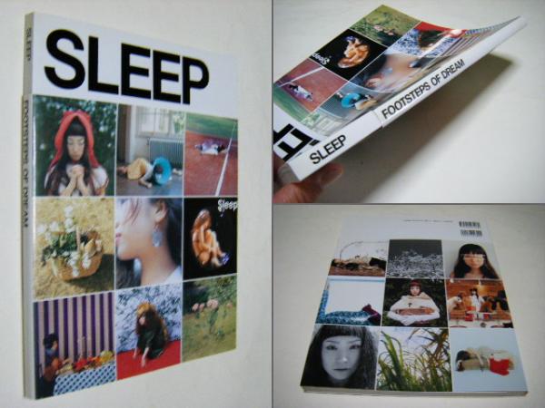
夢のあしあと SLEEP <FOOTSTEPS OF DREAM>

ミキ書房
埼玉県さいたま市南区大谷口
埼玉県さいたま市南区大谷口
¥963
佐内 正史;大森 克己;高橋 ヨーコ;鶴田 直樹;北島 明【ほか撮影】、ティー・ブックス、2003、・・・
初版 擦れ少折れ・ペーパーバック・写真集専門店・
百年
東京都武蔵野市吉祥寺本町
東京都武蔵野市吉祥寺本町
¥5,500
佐内正史 MASAFUMI SANAI、対照、2012、1
サイン入、角クセ僅少
※「状態」の表記に依らず解説をよくお読みいただいたうえでご注文ください
■配送 厚さや重さにあわせ、ゆうパケット250, 310, 360円、レターパック430, 600円、ゆうパック(80サイズ都内810円~)でご案内します。
■取り置き 店舗で受取希望の場合はご来店予定日をお知らせください。
■公費 ご注文承ります。必要書類・お支払い時期をお知らせください。
■営業時間 12時から20時 火曜定休
◆International shipping OK!◆
買取お気軽にご相談ください。


百年
東京都武蔵野市吉祥寺本町
東京都武蔵野市吉祥寺本町
¥1,320
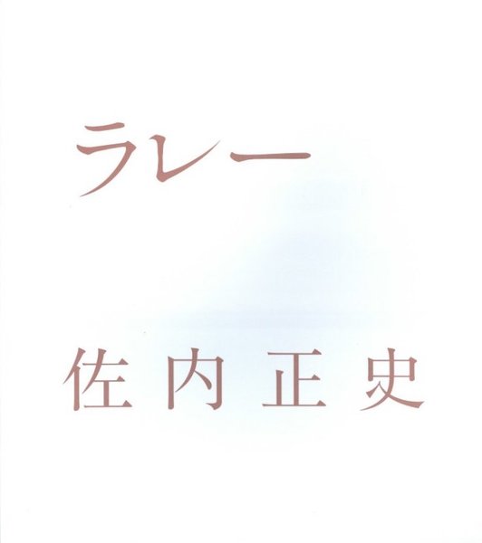
佐内正史、ピエ・ブックス、2001
初版、カバ・表紙スレ少
※「状態」の表記に依らず解説をよくお読みいただいたうえでご注文ください
■配送 厚さや重さにあわせ、ゆうパケット250, 310, 360円、レターパック430, 600円、ゆうパック(80サイズ都内810円~)でご案内します。
■取り置き 店舗で受取希望の場合はご来店予定日をお知らせください。
■公費 ご注文承ります。必要書類・お支払い時期をお知らせください。
■営業時間 12時から20時 火曜定休
◆International shipping OK!◆
買取お気軽にご相談ください。

かもがわ書店
京都府京都市北区小山西大野町
京都府京都市北区小山西大野町
¥2,000
(送料:¥300~)
佐内正史、A2
恐らくTrouble in Mindの附録かと思います。
★書込み等がある場合は解説に載せています(発送前に再度検品します)
★代金先払いです(一週間以内にお振込下さい)
★送料:(A4サイズ・厚さ3cm・重量1kgまで)ゆうメール300円 (上記以外で重量3kgまで)レターパック専用封筒に入るもの 600円 入らないもの 定形外郵便(規格外)~1330円 (重量3kg超)ゆうパック1200円(北海道、沖縄は1500円)
★かもがわ書店内の書籍検索は、店舗情報の「かもがわ書店」をクリックしてください
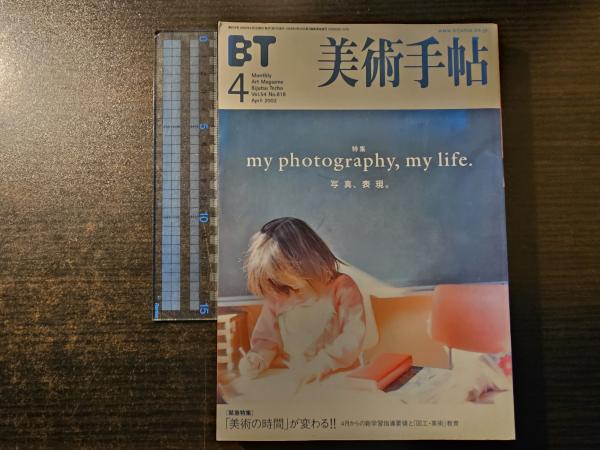
美術手帖 my photography, my life. 写真、表現。 54(818)

香風堂
千葉県銚子市笠上町
千葉県銚子市笠上町
¥500
(送料:¥200~)
美術出版社
日焼け、色褪せ。書き込み無し。
納品書は基本的に発行していません。ご希望のお客様はメッセージからご連絡ください。
配送は日本郵便にて行います。主にクリックポストを使用いたします。
送料は全国一律200円です。(レターパック・ゆうパックを除く)
複数ご注文の場合は当店の商品をかごに入れて進んでください。
大型の商品や全集、複数冊の購入など、レターパックやゆうパックが必要な場合は適正金額を頂戴しております。ご了承ください。
発送は代金お支払いの翌日が予定となります。都合によっては遅れることもございます。
AURA MAGAZINE Vol.1 2012 spring art&Photography
smokebooks(スモークブックス)
千葉県松戸市稔台1-21-1
千葉県松戸市稔台1-21-1
¥1,650
2012年 AURA MAGAZINE? ソフトカバー 21x28x0.5
本の状態:すれ 少
荒木経惟 佐内正史 ほか
中国の美術 写真雑誌
本の状態:すれ 少
荒木経惟 佐内正史 ほか
中国の美術 写真雑誌


太田書店(株)
静岡県静岡市葵区南沼上
静岡県静岡市葵区南沼上
¥500
(送料:¥350~)
荒木経惟・篠山紀信・佐内正史 他、東京都歴史文化財団、H12
スレ、小口ヤケ有り [ID:M84080]
★送料は商品の冊数にかかわらず全国一律 350円 です (ただし海外への発送の場合、送料は実費をご負担頂きます) ※海外への発送はしばらくの間休止いたします※
ノースブックセンター
東京都八王子市越野 8-23
東京都八王子市越野 8-23
¥3,627
(送料:¥350~)
佐内 正史、アーティストハウスパブリッシャーズ、1999年7月1日(発売年月日の記載となります、版・・・・
▼ 表紙:シミ▼ 全体的に使用感・経年感、ヤケ・シミ・汚れ等の傷み
送料は国内地域、書籍の重量や大きさに関わらず送料一律350円頂戴しております。
※日本国外への発送は行っておりません。(発送先が海外の場合は注文キャンセルとさせていただきます。)
※郵便局留め、センター留め、コンビニ受取は指定不可となります。
写真画報 2013 Spring : 荒木経惟×佐内正史 (玄光社MOOK)

翠ブックス
東京都杉並区西荻北
東京都杉並区西荻北
¥2,500
(送料:¥200~)
玄光社、2013年、143p、28.5 × 21.0 ㎝
ソフトカバー, カバー付き
地とカバー下部にシミあり
地とカバー下部にシミあり
■領収書をご希望の際は取引メッセージより、宛名および但し書きをお知らせください。
ヴォルス ブックス
東京都千代田区神田神保町
東京都千代田区神田神保町
¥3,500
HIROMIX、佐内正史、山本哲也、大森克己/撮影、プレビジョン
大判ソフトカバー80頁 カバー背角イタミ補修 帯 カバー少ヤケ 約36.5×26×0.7cm 2005
迅速、丁寧な発送をこころがけております。受注後に送料・お支払いのご案内メールをお送りします。
【領収証】ご希望の場合は発注時にお申し付けください。
発送方法は重量/サイズ/金額によって「クリックポスト」「レターパック」「クロネコ・こねこ便」「ゆうパック」「佐川急便」で発送いたします。
※レターパックに入らない書籍は宅急便等(600円~)での案内です
※商品価格等によりご案内が異なる場合があります
※詳しい送料表は↓にあります

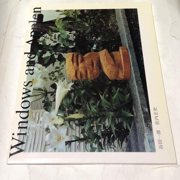
遊学文庫
東京都杉並区高円寺南
東京都杉並区高円寺南
¥2,200
写真:佐内正史/木彫り:谷田一郎、イマココ社、2005、1冊
少ヤケ 縁少スレ 状態良い方 30余枚 カラー写真図版 谷田の木彫りを写真家佐内が撮影したもの ソフトカバー 33x28.5cm
送料込みでない商品、あるいは複数冊のご注文の場合には、まず配送方法と送料についてご連絡申し上げます。
また、一人で営業しておりますので、お時間がかかる場合もございます。
土日、祝日はゆうパックの発送はしておりません。
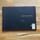
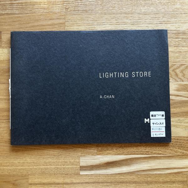
Lighting Store A-CHAN 写真集 限定700部<サンプル版>
ブックセンター・キャンパス
茨城県つくば市吾妻
茨城県つくば市吾妻
¥1,100
MATCH and Company Co., Ltd.、2012年
表紙シール、その他状態良好
サイン入りのシールが付いていますが、サインは有りません。
A-CHAN: 写真家・佐内正史のアシスタントを経て、、、
サイン入りのシールが付いていますが、サインは有りません。
A-CHAN: 写真家・佐内正史のアシスタントを経て、、、
広告批評 1999年10月 No.231 村上春樹ロングインタビュー・特集 コトバがそこにいる
書肆吉成
北海道札幌市東区北二十六条東七丁目
北海道札幌市東区北二十六条東七丁目
¥1,500
マドラ出版、平11、1
村上春樹「物語はいつも自発的でなければならない」、佐内正史、しりあがり寿、冬野さほ ほか 経年並
公費承ります。海外発送承ります。別途送料ゆうメール185円(梱包時34×25cm、厚3cm、1㎏以内)、430円(梱包時34×25cm、厚3cm、3㎏以内)、規格サイズを超える商品は、レターパックプラス600円か定形外郵便(規格外)かゆうパックのいずれか実費。 ※ゆうメールは曜日によって発送してからお届けまで最大5日ほどかかる場合がございます。 ※店頭にてお取引を希望の場合は必ず事前にご連絡ください。倉庫保管、在庫欠の場合がございます。


smokebooks(スモークブックス)
千葉県松戸市稔台1-21-1
千葉県松戸市稔台1-21-1
¥500
2001年 美術出版社 ペーパーバック 14.5×21×1.5
本の状態 表紙すれ 背のやけ
参加型企画「ヨコハマプロジェクト」鶴見俊輔×奈良美智
HIROMIX 佐内正史 ほか
?
本の状態 表紙すれ 背のやけ
参加型企画「ヨコハマプロジェクト」鶴見俊輔×奈良美智
HIROMIX 佐内正史 ほか
?
古書ワルツ 荻窪店
東京都杉並区荻窪
東京都杉並区荻窪
¥2,460
佐内正史、ソニー・マガジンズ/朝日新聞社、2002/2006、2
(シャンプーリン酢):紙装、(ロマンチック):文庫版。表紙・カバー極少日焼け、スレ、背極少イタミ有。(ロマンチック)に帯付(帯スレ有)。本体良好。初版。定価合計:2840円+税。白色カバー。
※(振込・公費不可)クレジット・キャリア決済のみ対応しています。
※店頭受け取りをご希望の方も必ずこちらからご注文ください。
日本の古本屋からご注文かつ、店頭現金支払いの方は100円引きいたします。
★送料について ①800g未満:ゆうメールまたはゆうパケット(300円)※(800g以下の場合でも3cmを超える場合はレターパック600での発送です)。/②800g以上:レターパック600(600円)/③ゆうパック1箱(880円)、④(北海道、四国、山口、九州)は1箱(1250円)
古書ワルツ 荻窪店
東京都杉並区荻窪
東京都杉並区荻窪
¥3,960
綾瀬はるか/佐内正史・ND CHOW・新津保建秀・Takao Noel(撮影)、講談社、2019~2・・・
カバー極少スレ有。2冊帯付(帯少スレ有)。本体良好。初版。定価合計:7500円+税。(01:台湾/02:ハワイ/03:リスボン/04:パース)。ピンク色/白色/青色カバー。極薄本。(03のみ)。
※(振込・公費不可)クレジット・キャリア決済のみ対応しています。
※店頭受け取りをご希望の方も必ずこちらからご注文ください。
日本の古本屋からご注文かつ、店頭現金支払いの方は100円引きいたします。
★送料について ①800g未満:ゆうメールまたはゆうパケット(300円)※(800g以下の場合でも3cmを超える場合はレターパック600での発送です)。/②800g以上:レターパック600(600円)/③ゆうパック1箱(880円)、④(北海道、四国、山口、九州)は1箱(1250円)
阿武隈書房
福島県いわき市平
福島県いわき市平
¥350
佐内正史 ほか著 ; Revolution Inc. 編、平凡社、2004.7、131p、21cm
初版: カバー:
経年焼けシミあり
本文に目立った書き込み等ございません
経年焼けシミあり
本文に目立った書き込み等ございません
古書 城田
福岡県北九州市小倉北区浅野
福岡県北九州市小倉北区浅野
¥4,400
石川直樹、上田義彦、金村修、川内倫子、塚田直寛、佐内正史、澁谷征司、高木こずえ、瀧本幹也、都築響一、・・・
クリックポスト、ゆうメール、レターパックライト、レターパックプラス、規格超過のため、「ゆうパック(持込割引) 80サイズ 対面手渡 追跡可能」 にて発送させて頂きます。(状態:経年並 表紙帯見返薄埃) 縦37×横37cm ハードカバー 帯付 1日を1時間ごとに24分割し、現代の日本を代表する写真家がその時間の東京を撮影。

ミキ書房
埼玉県さいたま市南区大谷口
埼玉県さいたま市南区大谷口
¥800
石井克人、今井智己、操上和美、groovisions、佐内正史、鈴木清順、瀧本幹也、奈良美智、野口里・・・
帯擦れ折れ カバー擦れ少折れ ペーパーバック・写真集専門店・7-3
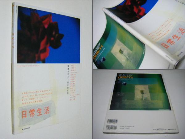
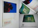
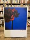
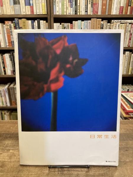
日常生活 : 写真の日々、日々の写真 <日本カメラMOOK>
古本のんき
東京都三鷹市中原
東京都三鷹市中原
¥800
(送料:¥200~)
日本カメラ社、平成15年、30cm
カバイタミ
花代、奈良美智、佐内正史、野村浩司、MOTOKO、groovisions、瀧本幹也、ヒロ杉山、繰上和美、野口里佳、鈴木清順、今井智己、Frederic Lebain、森山大道、石井克人、平間至、TALK
花代、奈良美智、佐内正史、野村浩司、MOTOKO、groovisions、瀧本幹也、ヒロ杉山、繰上和美、野口里佳、鈴木清順、今井智己、Frederic Lebain、森山大道、石井克人、平間至、TALK
ご入金確認後速やかに発送いたします。
※休業日には対応が遅れる場合がございます。予めご了承いただけましたら幸いです。
豆ノ木書房
千葉県八千代市高津東
千葉県八千代市高津東
¥680
(送料:¥0~)
忌野清志郎 堀江貴文 やくしまるえつこ 北村道子 中村うさぎ 佐内正史 三宅恵介 吉田豪 デヴィ夫人・・・
★税込 & 送料無料★ 中古書につき多少のイタミあり。帯なし。こちらの商品は★送料無料★でお届けいたします。
写真家になる! 1・2 全2冊 <CWSレクチャーブックス>
古本のんき
東京都三鷹市中原
東京都三鷹市中原
¥800
(送料:¥200~)
土岐小百合, 長嶺輝明 編、メタローグ、2001年、19cm
帯 カバイタミ少・ヨゴレ少
岩合光昭、伊島薫、長嶺輝明 、ホンマタカシ、都築響一、田中欣一、島尾伸三、今道子、佐藤時啓、森山大道、佐内正丈イタミ少・ヨゴレ少
岩合光昭、伊島薫、長嶺輝明 、ホンマタカシ、都築響一、田中欣一、島尾伸三、今道子、佐藤時啓、森山大道、佐内正史、蜷川実花、三好和義ほか
岩合光昭、伊島薫、長嶺輝明 、ホンマタカシ、都築響一、田中欣一、島尾伸三、今道子、佐藤時啓、森山大道、佐内正丈イタミ少・ヨゴレ少
岩合光昭、伊島薫、長嶺輝明 、ホンマタカシ、都築響一、田中欣一、島尾伸三、今道子、佐藤時啓、森山大道、佐内正史、蜷川実花、三好和義ほか
ご入金確認後速やかに発送いたします。
※休業日には対応が遅れる場合がございます。予めご了承いただけましたら幸いです。
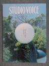
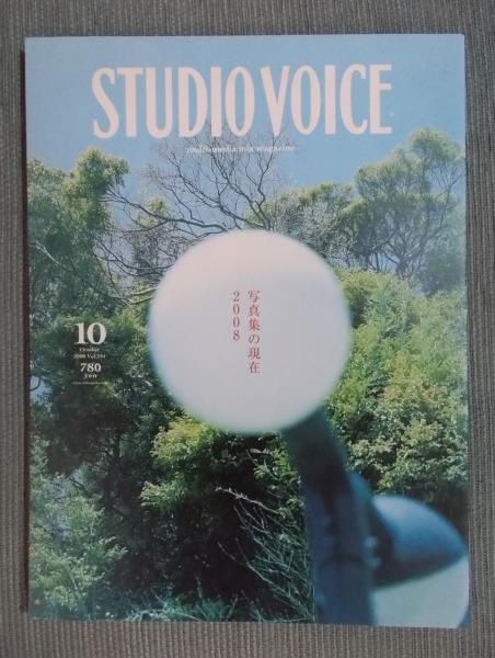
STUDIO VOICE スタジオ・ボイス Vol.394 2008年10月号 特集 写真集の現在2008
smokebooks(スモークブックス)
千葉県松戸市稔台1-21-1
千葉県松戸市稔台1-21-1
¥800
2008年 インファス ペーパーバック 23×30×1
本の状態 表紙すれ やけ
インタビュー スティーブン・ギルティム・バーバー
対談 佐内正史×伊賀大介 姫野希美×平野太呂
アメリカン・イメージ の系譜を辿る女性写真家たちの最新動向 ほか
?
本の状態 表紙すれ やけ
インタビュー スティーブン・ギルティム・バーバー
対談 佐内正史×伊賀大介 姫野希美×平野太呂
アメリカン・イメージ の系譜を辿る女性写真家たちの最新動向 ほか
?
STUDIO VOICEスタジオ・ボイス 特集「写真集の現在 2008」 2008年10月号
古書月航舎
東京都八王子市大和田町
東京都八王子市大和田町
¥500
特集執筆者:(インタビュー)スティーヴン・ギル/(対談)佐内正史×伊賀大介ほか、INFASパブリケー・・・
●定価743円+税●送料は厚紙ケースに入れて、「クリックポスト」なら185円です。●コンディション:並下。 画像2では分かりづらいですが、オモテ表紙に薄っすらシミあり。本文は天地小口に薄っすらヤケ。微かにスレキズもあり。本文印刷面も天地小口周辺に薄っすらヤケあり。ヤケ以外は良好です。
徘徊堂
福岡県福岡市城南区別府
福岡県福岡市城南区別府
¥1,500
アマナ
想像の根源を探る・谷口広樹 Macの究極環境を追う
井上よういち×池田昌子 佐内正史 東松照明
マルコ・グラヴィアーノ バートン・プリツカー
全体に経年並のヤケ・少イタミ・少ソリ
井上よういち×池田昌子 佐内正史 東松照明
マルコ・グラヴィアーノ バートン・プリツカー
全体に経年並のヤケ・少イタミ・少ソリ

ミキ書房
埼玉県さいたま市南区大谷口
埼玉県さいたま市南区大谷口
¥693
石田哲朗, 武内厚子, 伊藤貴弘編 ; ダン・アビー訳、東京都写真美術館、2017、157p、30c・・・
佐内正史、ホンマタカシ、高橋恭司、松江泰治、花代、野村佐紀子、北島敬三、やなぎみわ、石内都、金村修、川内倫子、野口里佳、大森克己、志賀理江子、その他 本体擦れ少折れ・ペーパーバック・写真集専門店・
ジャパニーズ・フォトグラファーズ : 14人の写真家たちの「いま」
シルバー書房
埼玉県川口市大字榛松
埼玉県川口市大字榛松
¥600
(送料:¥300~)
飯沢耕太郎 著、白水社、2005.12.30 初版、227p 図版16p、21cm
初版 帯薄ヤケ カバー付 三方薄ヤケ 書込みなし 経年並
入金確認後、2営業日以内に発送しております。

ビーバーズブックス
北海道札幌市中央区南十七条西8丁目1-32
北海道札幌市中央区南十七条西8丁目1-32
¥1,100
(送料:¥300~)
ブルース・インターアクションズ、2002、135p、19cm
B++ 帯付、おおむね良好、目立つダメージなし
・単品スピード注文いただければ早期発送可能です。
・複数購入は別途お見積りとなります。代金は基本的に「先払い」となります(公費購入は別途対応有)。
・クレジット決済または振込頂いてから2営業日以内に出荷いたします。代引きは取扱しておりません。
トラブルのないお取引を目指しております。よろしくお願いします。
角口書店
北海道札幌市中央区宮の森四条
北海道札幌市中央区宮の森四条
¥500
都市出版編 小特集 沿線に集まるクリエーター「中央線系」 (中野 浅草キッド/高円寺 HIROMIX・・・
表紙に僅すれ・背に少ヤケ 小口に僅ヤケと僅すれ・記事頁端に日ヤケ少 続、轡田隆史(FC東京の躍進に見る東京「サッカー文化」の考察/吉田大朋(東京都市 写真家のとらえた永井荷風の世界)/対談・田中優子×平岡正明(今宵、「江戸」を語る)/森まゆみ(聞き書き 岩崎久彌伝・7)ほか
送料は、実費です。
日本郵便のクリックポスト レターパックプラスまたはライト ゆうパック)の
料金表に基づきます。
海外発送の場合は、
EMSでのお取り扱いとなりますのでご了承ください。
大きさや重量により、選択させていただきます。
入金・決済の確認後に発送いたします。
東京人 2000年8月号 (156号) 特集 ホテルで過ごす東京の夏 (私の好きな子のホテル、この場所 緒川たまき/常盤新平/阿川佐和子/村松友視/椎名誠、大林宣彦、山藤章二、林望、柴門ふみ、石川次郎、陣内秀信、矢吹申彦、酒井順子、倉田保雄)
¥500
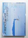
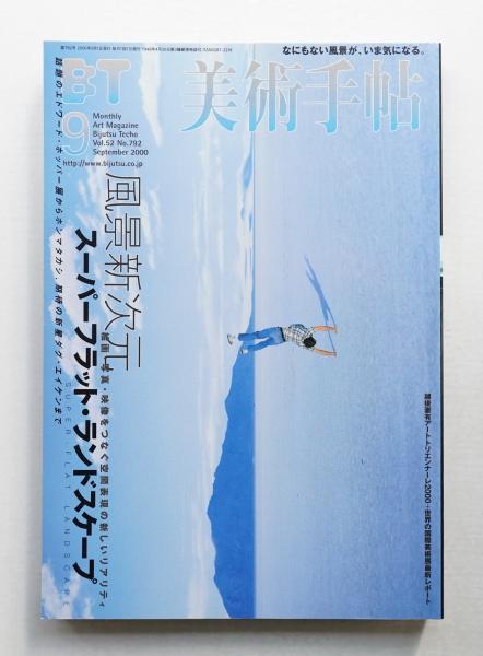
美術手帖 2000年9月号 No.792 <特集 : 風景新次元 スーパーフラット・ランドスケープ>
パージナ
東京都中央区日本橋富沢町4-6 Core-46 Bldg.
東京都中央区日本橋富沢町4-6 Core-46 Bldg.
¥1,100
編 : 伊藤憲夫、美術出版社、2000、258p、A5判、1冊
特集 : 風景新次元 スーパーフラット・ランドスケープ SUPER-FLAT LANDSCAPE 絵画・写真・映像をつなぐ空間表現の新しいリアリティ
図版構成 エドワード・ホッパー×ホンマタカシ KILL THE LANDSCAPE 殺風景
インタヴュー ダグ・エイケン / 川原英樹
インタヴュー 久家靖秀 / 編集部
インタヴュー モーリーン・ギャレース / 編集部
インタヴュー 佐内正史 / 編集部
テキスト なんでもない場所、万歳! 風景なき平坦な戦場 / 椹木野衣
テキスト 幻想=風景論、あるいは幻想=風景宣言 / 市原研太郎
テキスト 汎=風景的現在 / 倉石信乃
テキスト 時間に棲む風景 超個人的風景写真への試論 / 樹村緑
コラム 移り変わっていく風景は、人物より敏感かもしれない / 田村直毅インタヴュー
図版構成 SUPER-FLAT LANDSCAPE COMPILATION
ジュリアン・オピー
ハイナー・シリング
小野博
清野賀子
村上隆
中野正貴
デイヴィッド・ソープ
小粥丈晴&雄川愛
渡辺聡
松江泰治
廣瀬智央
ブー・ムーン
ミスター
ヴォルフガンク・ティルマンス
Special Report 世界の国際美術展最新リポート
マニフェスタ③ / 大友恵理
シドニー・ビエンナーレ2000 / 山口裕美
第5回リヨン・ビエンナーレ / 川原英樹
ハノーファー万博 / 紫牟田伸子
対談 / 北川フラム ; 安斎重男

もっと見る
書誌カタログから探す
「日本の古本屋」では、書籍ごとの基本情報を「書誌カタログ」にまとめております。書誌カタログからは欲しい本のリクエストが可能です。
お探しの本が「日本の古本屋」に追加された場合に自動通知をお送りさせていただきます。

-
リクエストを送る
-
書籍情報で在庫を検索
100万分の1日本地質図 : 数値地質図 G-1 第3版 CD-ROM版
Geological map of Japan 1:1,000,000 : Digital geoscience map G-1 日本地質図 : 100万分の1
通商産業省工業技術院地質調査所、1995.3
1枚
-
リクエストを送る
-
書籍情報で在庫を検索
100万分の1日本地質図 : 日本地質アトラス 第2刷(複製)
1:1,000,000 Geological map of Japan : geological atlas of Japan 日本地質図 : 100万分の1
通商産業省工業技術院地質調査所、1987.3
9枚 42×62cm
-
リクエストを送る
-
書籍情報で在庫を検索
-
リクエストを送る
-
書籍情報で在庫を検索
101 Great Games & Activities <Pfeiffer Electronic Downloads>
Edited by VanGundy, Arthur B.、John Wiley & Sons In・・・
372p H277 x W215
9781118296011
-
リクエストを送る
-
書籍情報で在庫を検索
101 Outer Space Projects for the Evil Genius <Evil Genius>
By (author) Prochnow, Dave、McGraw-Hill Education -・・・
300p H277 x W217
9780071485487
-
リクエストを送る
-
書籍情報で在庫を検索
百万分の一日本土壌図 Soil map of japan
ペドロジスト懇談会土壌分類・命名委員会編、ペドロジスト懇談会、[1990.3]
地図3枚, 凡例1枚 110×78cm (箱入り 28cm)
-
リクエストを送る
-
書籍情報で在庫を検索
-
リクエストを送る
-
書籍情報で在庫を検索
-
リクエストを送る
-
書籍情報で在庫を検索
-
リクエストを送る
-
書籍情報で在庫を検索
-
リクエストを送る
-
書籍情報で在庫を検索
-
リクエストを送る
-
書籍情報で在庫を検索
-
リクエストを送る
-
書籍情報で在庫を検索
-
リクエストを送る
-
書籍情報で在庫を検索
-
リクエストを送る
-
書籍情報で在庫を検索
-
リクエストを送る
-
書籍情報で在庫を検索

15th premium album : タクミくんシリーズイラスト&ファンブック
ごとうしのぶ, おおや和美 著、角川書店 角川グループパブリッシング、2007.12
98p 26cm
978-4-04-854154-1
-
リクエストを送る
-
書籍情報で在庫を検索

-
リクエストを送る
-
書籍情報で在庫を検索
-
リクエストを送る
-
書籍情報で在庫を検索
一八四〇年シーボルト著日本図ならびに一八一一年アロースミス著日本図
Karte [v]om Japanischen Reiche nach Originalkarten und astronomischen Beobachtungen der japaner : die Inseln Kiu siu Sikok und Nippon : dem Kaiserl. Russ. Admral von Krusenstern aus Hochachtung und Dankbarkeit gewidmet Map of the Islands of Japan Kurile &c. : with the adjacent coast of the Chinese dominions and a sketch of the River Amoor and the Baikal Lake including the trading posts of Russia and China and their relative situations with Peking
[秋岡武次郎著]、大日本測量、[1967]
25p 26cm
-
リクエストを送る
-
書籍情報で在庫を検索
-
リクエストを送る
-
書籍情報で在庫を検索
1991 Sophia University around the campus : a graphic map
produced by Nippon Graphic Map Co. ; copyright by ・・・
1 map : col. 110×80 cm
-
リクエストを送る
-
書籍情報で在庫を検索
1992 Central Tokyo graphic map around the Imperial palace garden 第4回改訂版.
洲嵜晴彦 著 ; 日本グラフィックマップ 制作、日本グラフィックマップ、1992.6
地図 1枚 : 色刷 80×110cm
-
リクエストを送る
-
書籍情報で在庫を検索
1992 Ginza graphic map around the Ginza 第6回改訂版.
洲嵜晴彦 著 ; 日本グラフィックマップ 制作、日本グラフィックマップ、1992.2
地図 1枚 : 色刷 110×80cm
-
リクエストを送る
-
書籍情報で在庫を検索
Groundsurface displacement map for the 1995 Hyougoken-nanbu earthquake 1995年兵庫県南部地震による地表面変位量図 = Groundsurface displacement map for the 1995 Hyougoken-nanbu earthquake 一九九五年兵庫県南部地震による地表面変位量図
田中耕平 [著]、防災科学技術研究所、1996.9
53枚 37×49cm
-
リクエストを送る
-
書籍情報で在庫を検索
Groundsurface displacement map for the 1995 Hyogoken-nanbu earthquake
防災科学技術研究所、1996.9
53枚 38×49cm
-
リクエストを送る
-
書籍情報で在庫を検索
1997年八幡平澄川地すべり災害地形分類図 <国土地理院技術資料>
Land condition map of the landslide disaster in Hachimantai-Sumikawa in 1997 八幡平澄川地すべり災害地形分類図
国土地理院地理調査部地理第一課[編]、国土地理院、1997.3
地図1枚 109×78cm (折りたたみ27cm)
-
リクエストを送る
-
書籍情報で在庫を検索
-
リクエストを送る
-
書籍情報で在庫を検索

一人一人の活動と参加を高める領域・教科を合わせた指導 : 知的障害児の自立を目指して
石塚謙二 監修 ; 全国特別支援学校知的障害教育校長会 編著、明治図書、2012.4
148p 26cm
978-4-18-088213-7
-
リクエストを送る
-
書籍情報で在庫を検索
Explanatory text to the agronomic map of Iki and Tsushima Provinces and the South-western part of Hizen Province 壹岐対馬全国及肥前国西南部土性図説明書
[農商務省地質調査所]、製紙分社 金田新太郎、1894.4
3, 3, 378p 23cm
-
リクエストを送る
-
書籍情報で在庫を検索
もっと見る
かもがわ書店の新着書籍
かもがわ書店
京都府京都市北区小山西大野町
京都府京都市北区小山西大野町
¥80,000
(送料:¥1,200~)
東京法令、6冊、27cm
外函ややヤケシミ 本文概ね良好 ゆうパック
★書込み等がある場合は解説に載せています(発送前に再度検品します)
★代金先払いです(一週間以内にお振込下さい)
★送料:(A4サイズ・厚さ3cm・重量1kgまで)ゆうメール300円 (上記以外で重量3kgまで)レターパック専用封筒に入るもの 600円 入らないもの 定形外郵便(規格外)~1330円 (重量3kg超)ゆうパック1200円(北海道、沖縄は1500円)
★かもがわ書店内の書籍検索は、店舗情報の「かもがわ書店」をクリックしてください
かもがわ書店
京都府京都市北区小山西大野町
京都府京都市北区小山西大野町
¥2,000
(送料:¥300~)
杉山正明編 ; 岩本佳子 [ほか] 著、京都大学大学院文学研究科、xliii, 160p、30cm
良好 送料300円
★書込み等がある場合は解説に載せています(発送前に再度検品します)
★代金先払いです(一週間以内にお振込下さい)
★送料:(A4サイズ・厚さ3cm・重量1kgまで)ゆうメール300円 (上記以外で重量3kgまで)レターパック専用封筒に入るもの 600円 入らないもの 定形外郵便(規格外)~1330円 (重量3kg超)ゆうパック1200円(北海道、沖縄は1500円)
★かもがわ書店内の書籍検索は、店舗情報の「かもがわ書店」をクリックしてください

かもがわ書店
京都府京都市北区小山西大野町
京都府京都市北区小山西大野町
¥800
(送料:¥300~)
曽先之 原著 ; 竹内弘行 著、講談社、554p、15cm
カバー小傷 本文良好 送料300円
★書込み等がある場合は解説に載せています(発送前に再度検品します)
★代金先払いです(一週間以内にお振込下さい)
★送料:(A4サイズ・厚さ3cm・重量1kgまで)ゆうメール300円 (上記以外で重量3kgまで)レターパック専用封筒に入るもの 600円 入らないもの 定形外郵便(規格外)~1330円 (重量3kg超)ゆうパック1200円(北海道、沖縄は1500円)
★かもがわ書店内の書籍検索は、店舗情報の「かもがわ書店」をクリックしてください
日中戦争への道 : 満蒙華北問題と衝突への分岐点 <講談社学術文庫>
かもがわ書店
京都府京都市北区小山西大野町
京都府京都市北区小山西大野町
¥900
(送料:¥300~)
大杉一雄 著、講談社、452p、15cm
カバー小傷 本文概ね良好 送料300円
★書込み等がある場合は解説に載せています(発送前に再度検品します)
★代金先払いです(一週間以内にお振込下さい)
★送料:(A4サイズ・厚さ3cm・重量1kgまで)ゆうメール300円 (上記以外で重量3kgまで)レターパック専用封筒に入るもの 600円 入らないもの 定形外郵便(規格外)~1330円 (重量3kg超)ゆうパック1200円(北海道、沖縄は1500円)
★かもがわ書店内の書籍検索は、店舗情報の「かもがわ書店」をクリックしてください
かもがわ書店
京都府京都市北区小山西大野町
京都府京都市北区小山西大野町
¥700
(送料:¥300~)
島田俊彦 著、講談社、405p、15cm
カバー小傷 本文概ね良好 送料300円
★書込み等がある場合は解説に載せています(発送前に再度検品します)
★代金先払いです(一週間以内にお振込下さい)
★送料:(A4サイズ・厚さ3cm・重量1kgまで)ゆうメール300円 (上記以外で重量3kgまで)レターパック専用封筒に入るもの 600円 入らないもの 定形外郵便(規格外)~1330円 (重量3kg超)ゆうパック1200円(北海道、沖縄は1500円)
★かもがわ書店内の書籍検索は、店舗情報の「かもがわ書店」をクリックしてください
かもがわ書店
京都府京都市北区小山西大野町
京都府京都市北区小山西大野町
¥400
(送料:¥300~)
早川庄八 著、講談社、301p、15cm
カバー小傷 本文良好 送料300円
★書込み等がある場合は解説に載せています(発送前に再度検品します)
★代金先払いです(一週間以内にお振込下さい)
★送料:(A4サイズ・厚さ3cm・重量1kgまで)ゆうメール300円 (上記以外で重量3kgまで)レターパック専用封筒に入るもの 600円 入らないもの 定形外郵便(規格外)~1330円 (重量3kg超)ゆうパック1200円(北海道、沖縄は1500円)
★かもがわ書店内の書籍検索は、店舗情報の「かもがわ書店」をクリックしてください
かもがわ書店
京都府京都市北区小山西大野町
京都府京都市北区小山西大野町
¥900
(送料:¥300~)
川勝義雄 著、講談社、493p、15cm
カバー小傷 本文概ね良好 送料300円
★書込み等がある場合は解説に載せています(発送前に再度検品します)
★代金先払いです(一週間以内にお振込下さい)
★送料:(A4サイズ・厚さ3cm・重量1kgまで)ゆうメール300円 (上記以外で重量3kgまで)レターパック専用封筒に入るもの 600円 入らないもの 定形外郵便(規格外)~1330円 (重量3kg超)ゆうパック1200円(北海道、沖縄は1500円)
★かもがわ書店内の書籍検索は、店舗情報の「かもがわ書店」をクリックしてください
かもがわ書店
京都府京都市北区小山西大野町
京都府京都市北区小山西大野町
¥700
(送料:¥300~)
花田清輝 著、講談社、315p、15cm
カバー小傷 本文ヤケ 帯付 送料300円
★書込み等がある場合は解説に載せています(発送前に再度検品します)
★代金先払いです(一週間以内にお振込下さい)
★送料:(A4サイズ・厚さ3cm・重量1kgまで)ゆうメール300円 (上記以外で重量3kgまで)レターパック専用封筒に入るもの 600円 入らないもの 定形外郵便(規格外)~1330円 (重量3kg超)ゆうパック1200円(北海道、沖縄は1500円)
★かもがわ書店内の書籍検索は、店舗情報の「かもがわ書店」をクリックしてください